


The Tibesti Massif: A Landscape of Chaos and the Highest Mountains in the Sahara
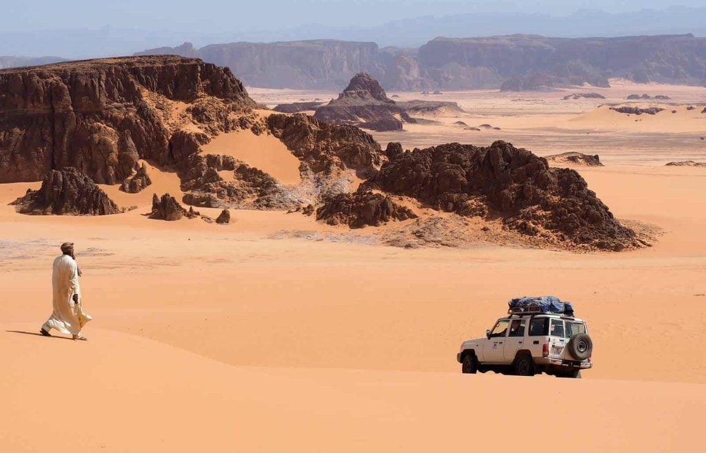
The Tibesti Massif is an isolated volcanic cataclysm, composed of mountains of rugged, bare rock, endless plains of stones, rivers of lava, sandstone cliffs rising steeply from the ground, improbable rock formations, sandy areas, lush oases that have become true wonders of nature, and winding roads that make it impossible to travel faster than 5 kilometers per hour.
The Tibesti is the most remote and inaccessible part of the Sahara, a volcanic mountain range 380 km long and one of the most isolated regions on the planet. Known as the roof of the Sahara with its volcanoes towering over 3,000 meters and breathtaking volcanic craters such as the Trou de Natron, the volcanic labyrinth of Tibesti offers an extraordinary and demanding travel experience.

Tibesti is synonymous with utterly desolate and breathtaking lunar landscapes inhabited by the feared Tubus (mountain people), the toughest of the tough. All of this is accompanied by an “atmosphere” of genuine gold rush fever that makes this region a true last frontier.
Scattered throughout the Tibesti are countless sites featuring rock engravings and cave paintings. With their vivid images, they tell the story of the drastic climate change the region has undergone.
Travel to Tibesti
The Tibesti is located more than 1,200 kilometers from the capital, N’Djamena, in the remote northwest of Chad, bordering Libya and Niger.
Extremely difficult to access and subject to travel restrictions, the Tibesti was a forbidden region for long periods of time due to its wars and conflicts.
Today, it is possible to visit the area—provided you take the necessary precautions and are always open to changes in plans. We don’t know how long this will last, so we encourage readers interested in visiting this remote part of Africa to embark on one of the last true expeditions left on our planet.

Mountains of Tibesti, the roof of the Sahara
The Tibesti region is home to the highest peaks in the Sahara, including Emi Koussi (3,445 m), Pico Toussidé (3,313 m), Tarso Voon (3,100 m), and Tarso Toon (2,625 m).
Once you begin the ascent toward the Trou de Natron from Zoua, the average elevation of the route through the Tibesti Mountains is around 1,300–1,500 meters.
Expedition to Tibesti: From N’Djamena to the Mountains of Northern Chad
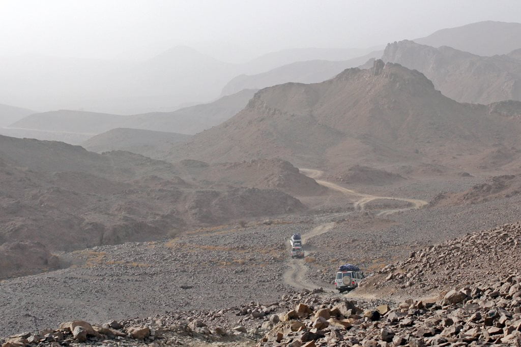
Leaving N’Djamena, the capital of Chad, behind, the paved road disappears within the first few hours of the trip. Ahead lie 4,000 kilometres of travel along sandy tracks, dirt roads and rocky terrain. After passing Masaguet and Massakory—cities well connected to the capital by paved roads—the route takes us toward Mao, the capital of the Sultanate of Kanem-Bornu.
Mao, the former capital of the Kanem-Bornu Empire
Mao has a medieval and historic atmosphere unlike that of almost any other city in Chad. Its impressive market is superbly stocked with goods from Libya, Niger, N’Djamena, and Lake Chad.

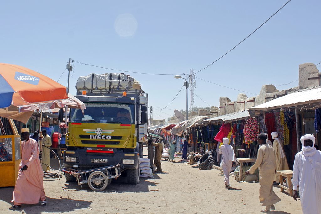
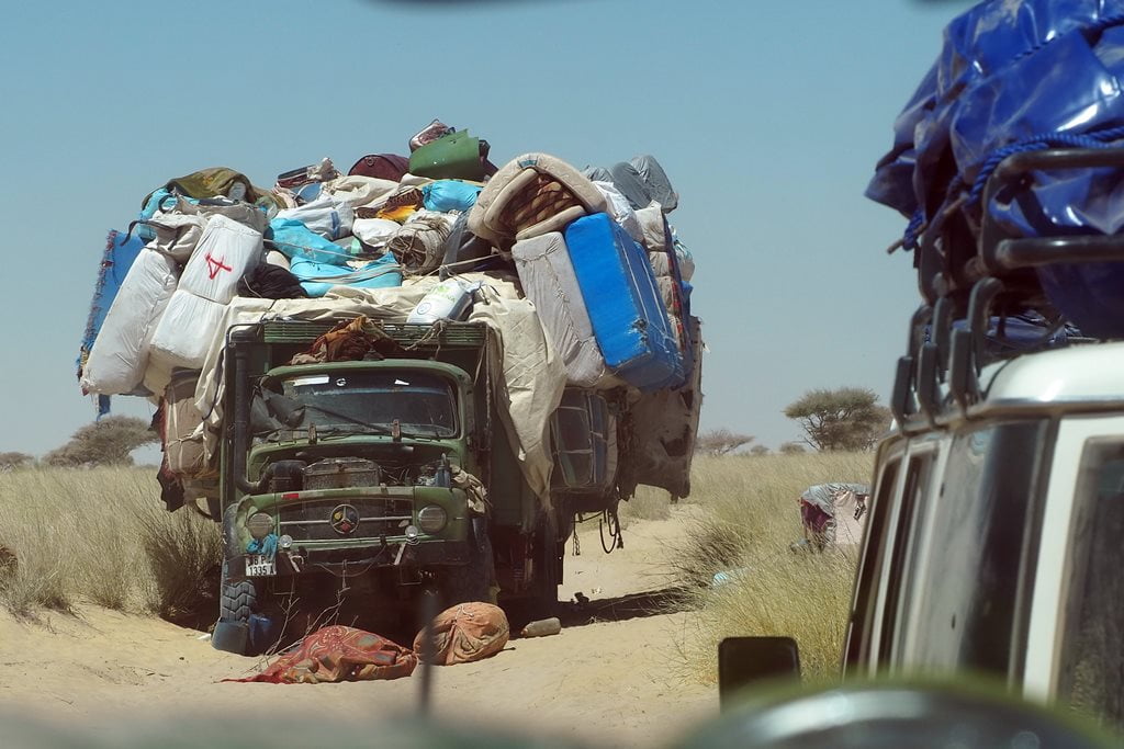
In this region of Kanem, especially along the route from Mao to Libya, you can see the iconic sight of old Mercedes trucks loaded to the brim with goods from Libya, with dozens of passengers piled on top.
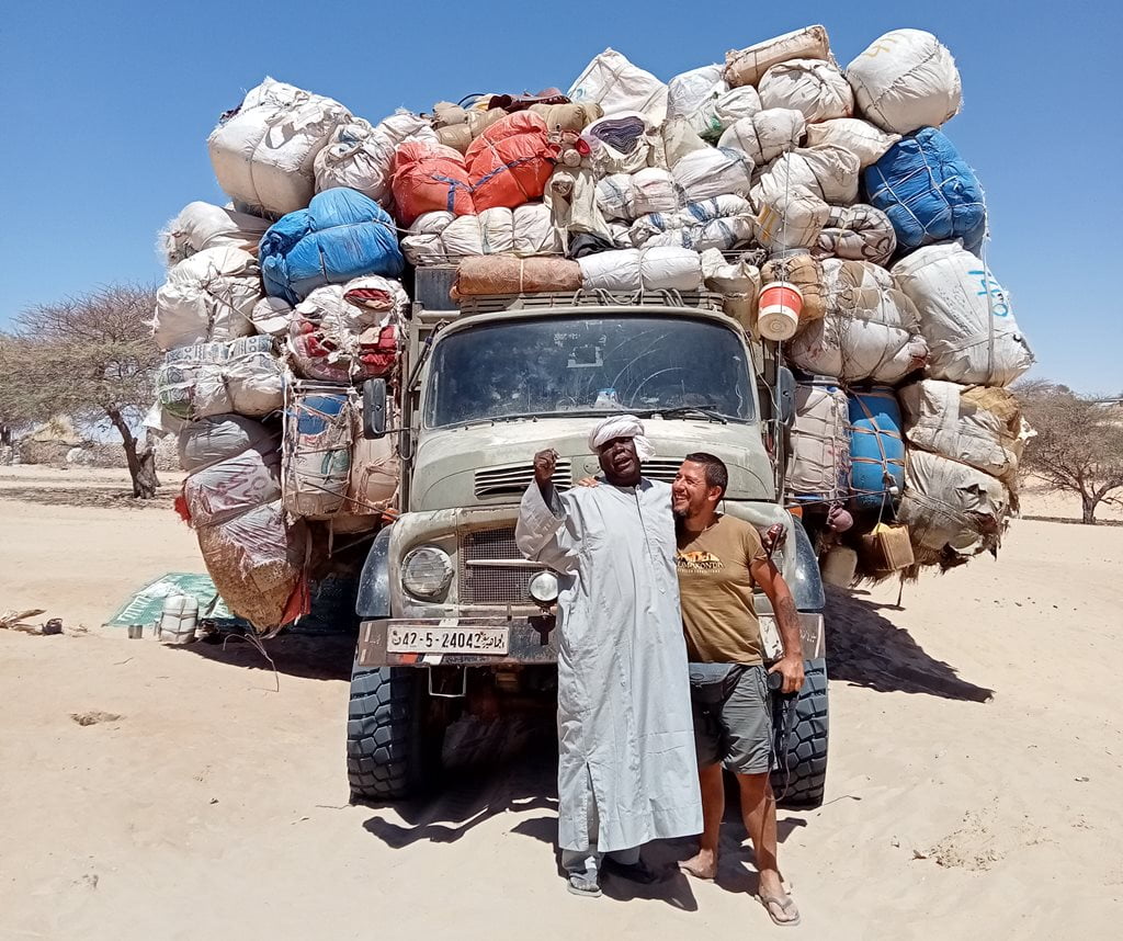
On our 2022 expedition, we attempted to meet with the Sultan of Kanem-Bornu, but unfortunately he was not in the city. On subsequent trips, we were able to do so.
Kanem-Bornu was a precolonial African empire that flourished in the territories of Chad, Nigeria, Niger, Libya, and Cameroon. Its existence over the course of a millennium also makes it one of the longest-lasting African civilizations and, therefore, a point of interest on our trips to Tibesti.
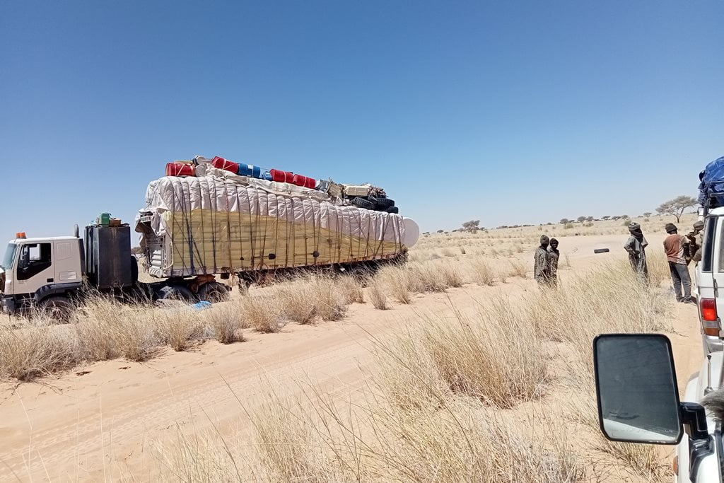
From Mao onward, the road leading to the Tibesti becomes difficult and inhospitable, winding its way toward the border with Niger. We encounter very few vehicles in this remote part of Chad—just a few trucks carrying passengers and goods from Libya.
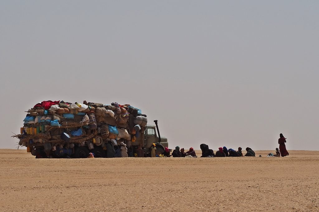
The harshness of this land is laid bare before us during these first few days of our trip. We stop several times to help with trucks that have broken down along the route. They’ve been stranded in the middle of nowhere for several days, surviving on the bare minimum and with very little water. They don’t know when they’ll be able to leave, nor do they have any way to contact the truck’s owners, who are in Zouar, more than 700 kilometers away. Next to the truck, sheltering from a strong harmattan wind, women, babies, and the elderly entrust their fate to Allah and wait indefinitely for someone to come and rescue them.
The Long Journey Through the Desert to Tibesti
On the remote desert route connecting Mao and Zouar—about 1,000 kilometers—there is practically nothing. There are only a couple of towns of any size—crossroads where travelers can buy some supplies, refill their water, and, in the case of Soultou, the main town along the route, refuel their vehicles with Libyan gasoline.
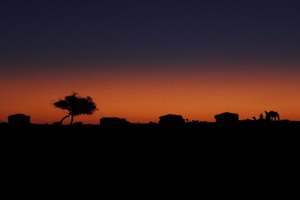
On this long journey from the Sahel to the endless desert plains, we enjoyed some magical sunsets and a few encounters with friendly Daza herders.

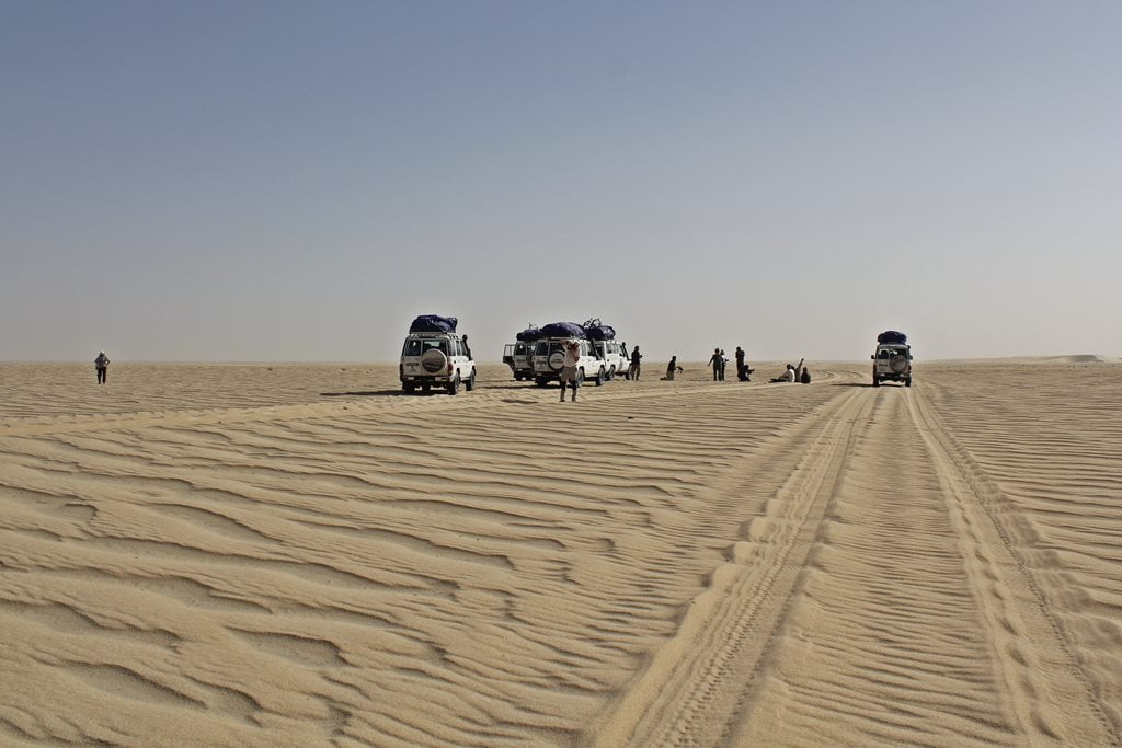
Sarh or Soltou, near the border with Niger
Arriving in Soltou was like landing on another planet. That day, the harmattan was terrible, making it hard to see and even difficult to take a single step outside the car. Even so, the two-hour stop in this town, located no more than 10 km from Niger, was incredibly interesting.
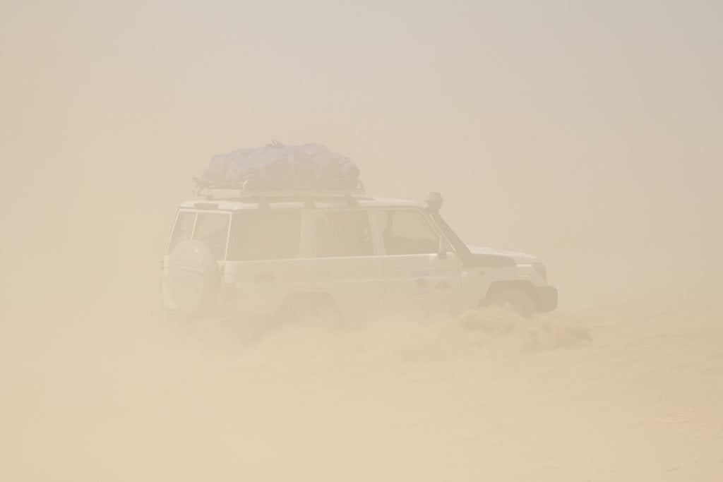
The atmosphere created by the dust haze, the nomads, the abandoned vehicles from Libya, and the houses scattered here and there made for some eerie scenes.

As is customary on all our trips in Chad, every two or three days we have to refuel, stock up on fresh food if available, get water, and buy an Asian luxury item like a somewhat cold cola. In addition, since this is a town of some strategic importance, we had to report to the local authorities and present our trip permits.


We continued our trip across endless sandy plains dotted with dunes to the Enneri (dry river) Erkoub, seeking shelter from the wind among some trees.
The protection and cover provided by the numerous trees and dunes of Enneri Erkoub served as military outposts during Chad’s various wars. As we saw for ourselves, there were also very recent traces of the fighting that took place in 2021 between the rebels and the army.
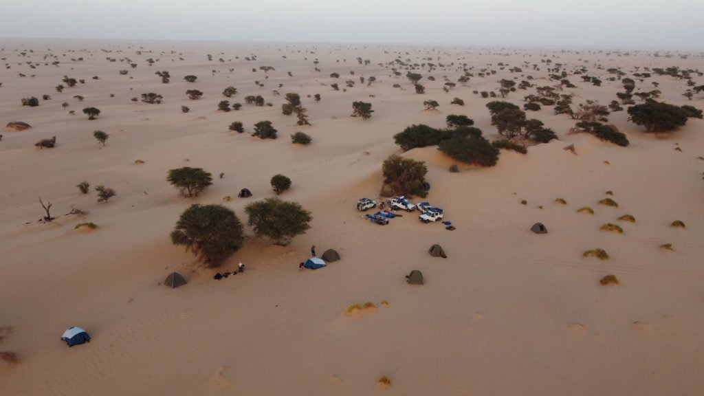

The Enneris are the dry riverbeds in the Tibesti. In Arabic and in the rest of Chad, these dry riverbeds are called wadis or ouadis. Along them, we always find wells where we can get clean water; many of them are simply holes in the ground.

Ehi Atroun, a monolith in the middle of the desert
After several days of traveling, we arrived at Ehi Atroun, which meant we weren’t far from the Tibesti Mountains. Many of us were already thinking about the first highlight of the trip: the Trou de Natron.
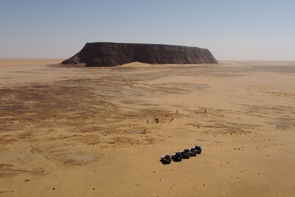
Ehi Atroun is a massive stone monolith located on a vast desert plain. This monolith, whose walls feature various rock art sites, has served since time immemorial as a beacon and landmark in the desert. Some say it bears a certain resemblance to Australia’s Uluru.
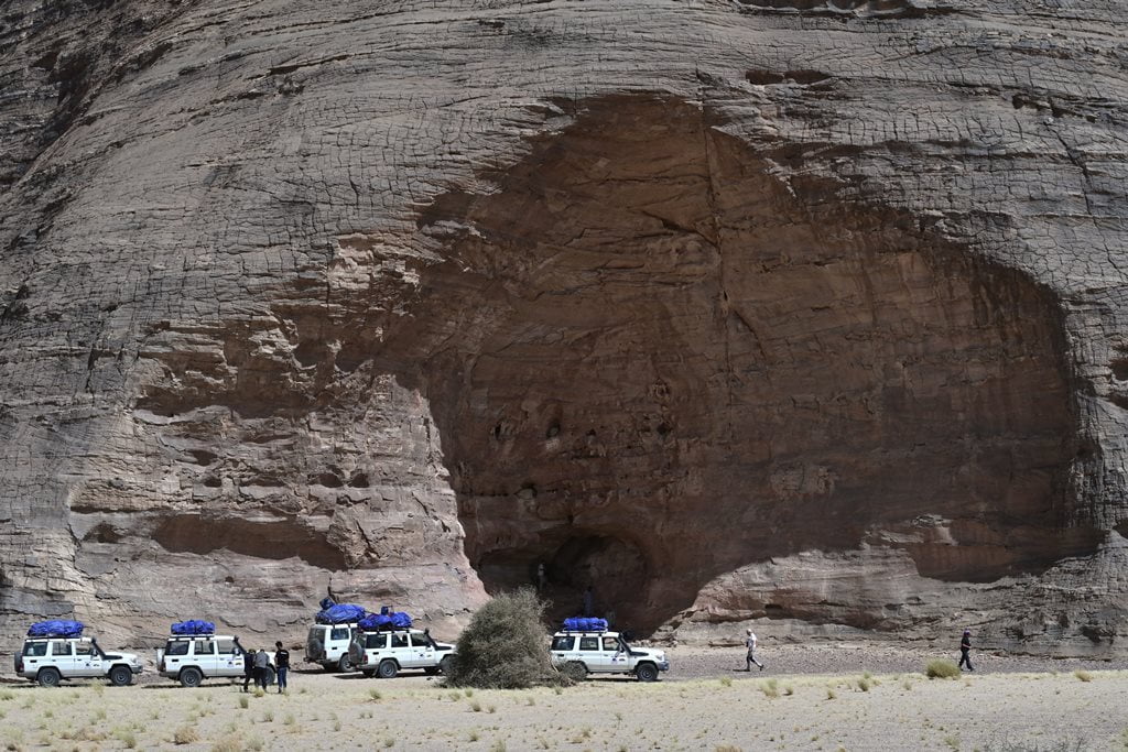
Erg Bilma, a sea of dunes in the Sahara
After several days of monotonous landscapes, only broken by some wadis, some villages and the Ehi Atroun, we arrive at a spectacular chain of dunes: the mythical sea of sand from Niger of Erg Bilma. The wide track that connects, already in this section, Faya with Zouarke and Libya, runs through beautiful and stylized golden dunes.

The Heart of the Tibesti: Canyons, Oases, and Trade Routes
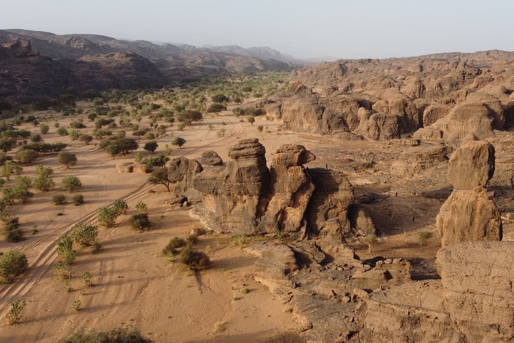
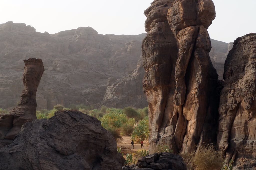
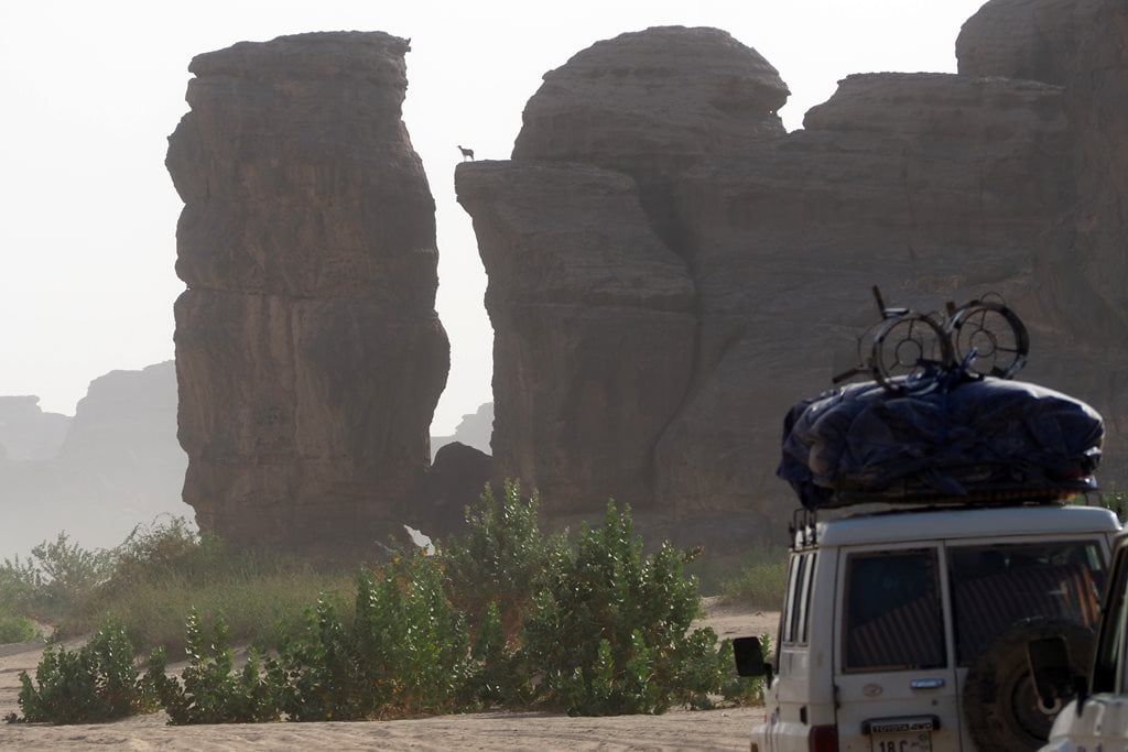
The Zouar Canyon, one of the most spectacular landscapes in Tibesti
The Zouar Canyon, or Enneri Zouar, is, in my opinion, the most picturesque, beautiful, and perhaps also the most important river valley of all those we know of in the Tibesti Massif.
After five long days of traveling along the lonely roads of the Sahel and across endless desert plains, arriving at the Zouar Canyon—with its lush vegetation and incredible rock formations—was absolutely wonderful. We were entering the Tibesti Mountains.
It would take several days to explore this charming valley of Zouar, but the lack of any information about it and the uncertainty of what lay ahead on an expedition as demanding as this one in the Tibesti Mountains meant that we spent only one afternoon and one morning there.
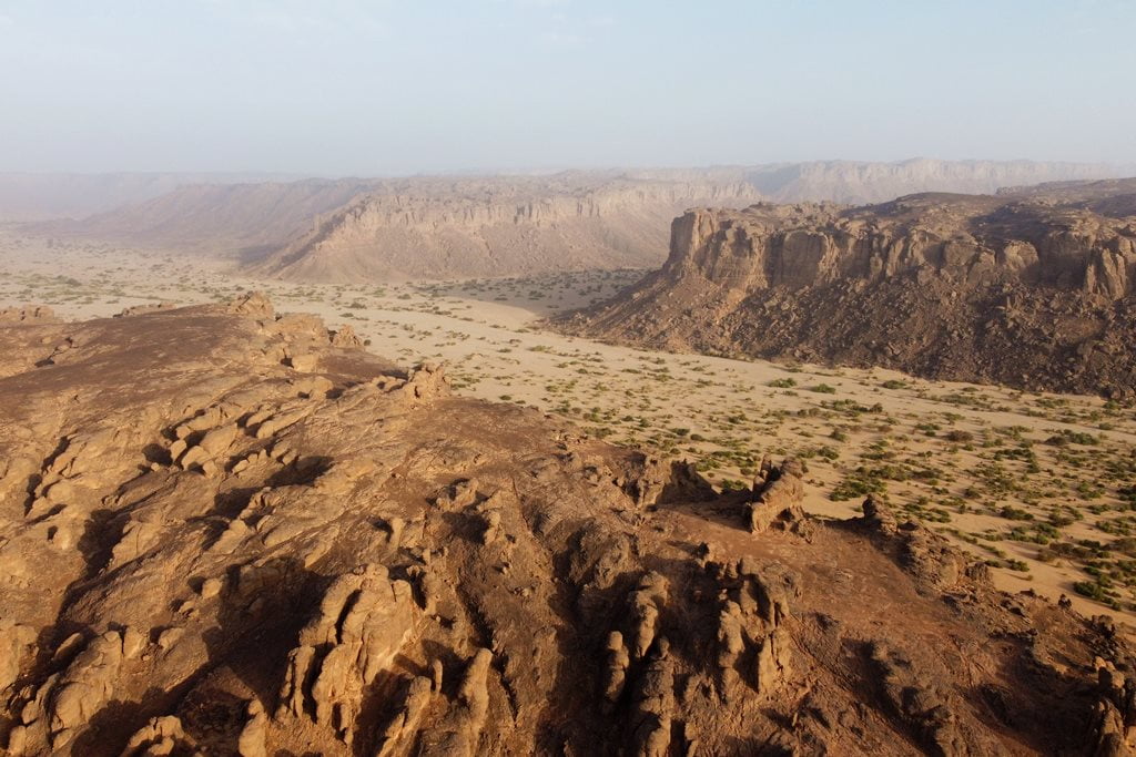
Zouar and Zouarke, towns in the Chadian Sahara
After restocking on water, diesel, and fresh food in Zouar and Zouarke, we set off into the depths of the volcanic labyrinth of the Tibesti Massif.
The feeling of arriving in the town of Zouar—with its large market full of goods, its restaurants, its bars, and even its internet café—was like that of someone arriving in a city for the first time after living in the countryside. Some passengers also stocked up on blankets for the cold nights in Tibesti.
In both Zouar and Zouarke, a large portion of the businesses are dedicated to buying and selling gold and meeting all the miners’ logistical needs. Furthermore, Zouarke is an impressive transportation hub, undoubtedly one of the main centers of trade in the entire Sahara.
From Zouarke, the route splits into two: the first, which is very difficult, leads to Bardai via the Trou de Natron, and the other, the main route, leads to Libya and Bardai and is also suitable for trucks.
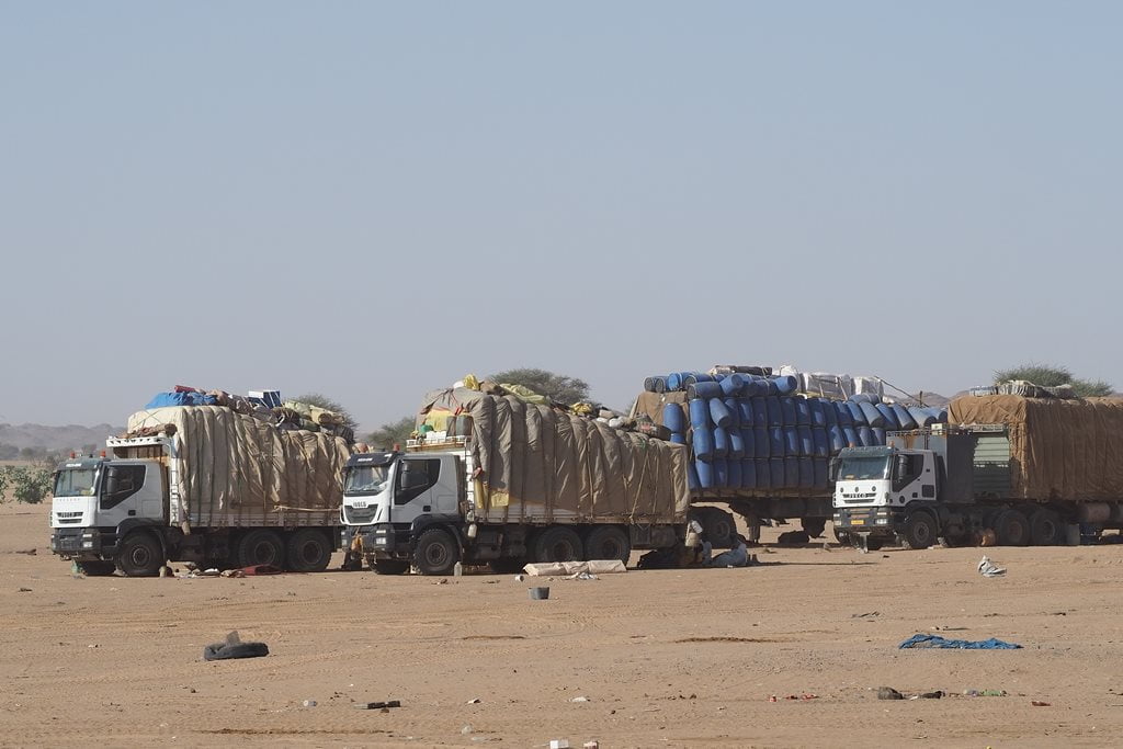
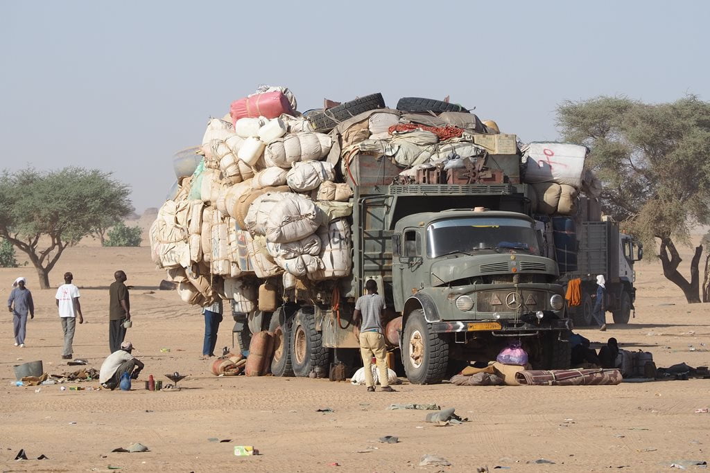

The trade route between Libya and Chad: truck drivers
One of the busiest trade routes in the Sahara is the one that connects Sabha in Libya with Mao, Mossouro, and/or N’Djamena in Chad through the Tibesti Mountains.
Dozens of trucks deliver Libyan goods (sugar, tea, fuel, packaged foods, machinery, etc.) to northern and central Chad, a landlocked country with few resources (the south is supplied from Douala, Cameroon). Even today, despite all the problems the country is facing, Libya remains the economic powerhouse of the entire region.
The remote town of Zouarke is also surprisingly well-stocked with goods and fresh food, and even has electricity and Wi-Fi—something unusual in this part of the world. Many truck drivers stop in Zouarke to rest up and continue across the sands toward the southern part of the country. It’s a journey that takes them about 20 days, if all goes well and no problems arise.
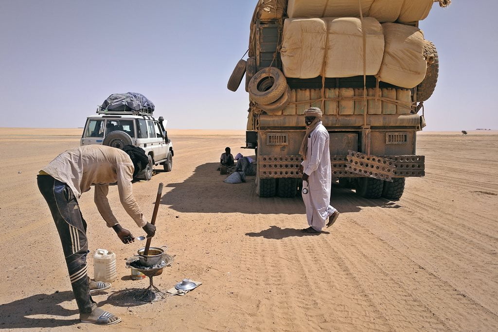
Each truck driver has two assistants who are in charge of cooking, making tea, fixing minor mechanical problems, and adjusting tire pressure—the main task when driving through the desert. The drivers rest in the shade of the truck while, under the blazing sun, the assistant cooks a simple stew made of okra and sun-dried tomatoes.
The unwritten rules in this part of the world say that the drivers are usually of Sudanese origin, and the truck owners are of Tubu origin.
From Trou de Natron to Bardai: Gorges and Rock Art
Track to the Trou de Natron
After the last checkpoint, the route climbs toward the Trou de Natron along a rocky trail that winds through dry riverbeds, volcanic ravines, and rocky plains.
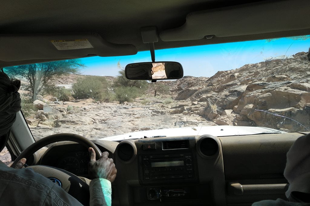
First straight ahead and then to our left, Mount Tousside, at 3,313 meters, is the second-highest peak in the Sahara. At its base lies the Trou de Natron crater. As we climbed, another great peak came into view to our right: Mount Botoum, which was equally impressive.

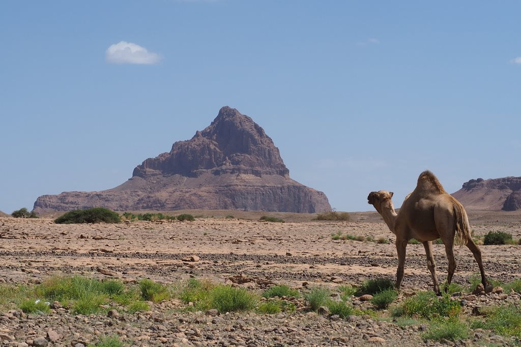
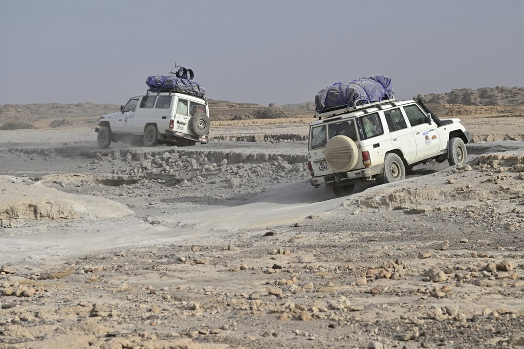
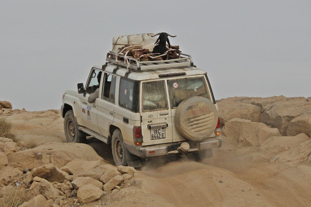
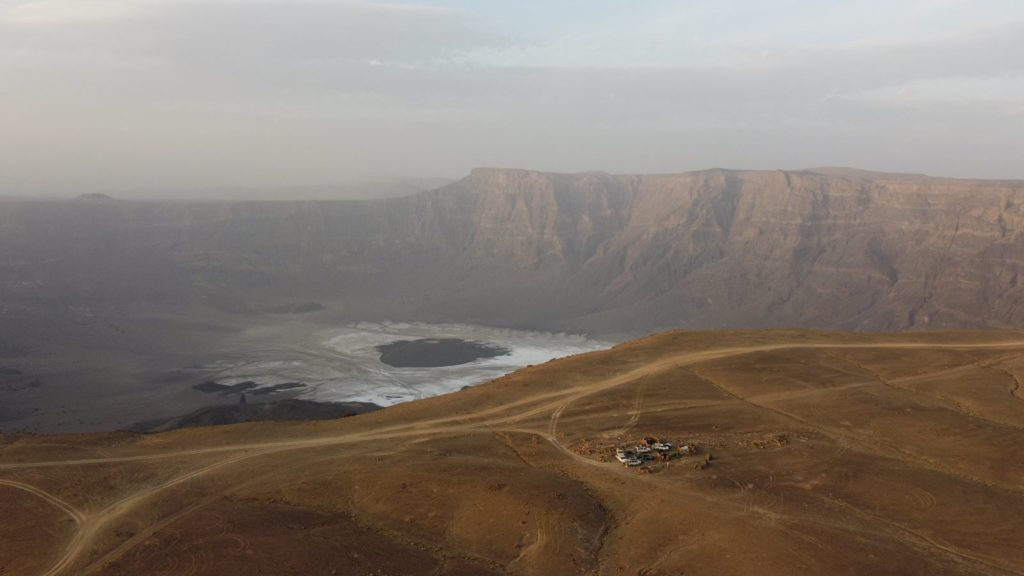
It took us many hours to cover the few dozen kilometers separating Zouarke from the rim of the Trou de Natron crater. In fact, we didn’t arrive at a small shelter-camp near the caldera until well into the night.
As you can see in the photos, this section of the trail is incredibly tough and challenging. The first three photos are courtesy of our travel companion and photographer, Javier Herranz Casellas.


Volcano caldera of Trou de Natron, the abyss
At the foot of Mount Toussidé (3,313 m), the second-highest volcano in the Tibesti Mountains, lies one of the most spectacular sites in the Tibesti Mountains and in all of Chad: the Trou de Natron volcanic caldera.
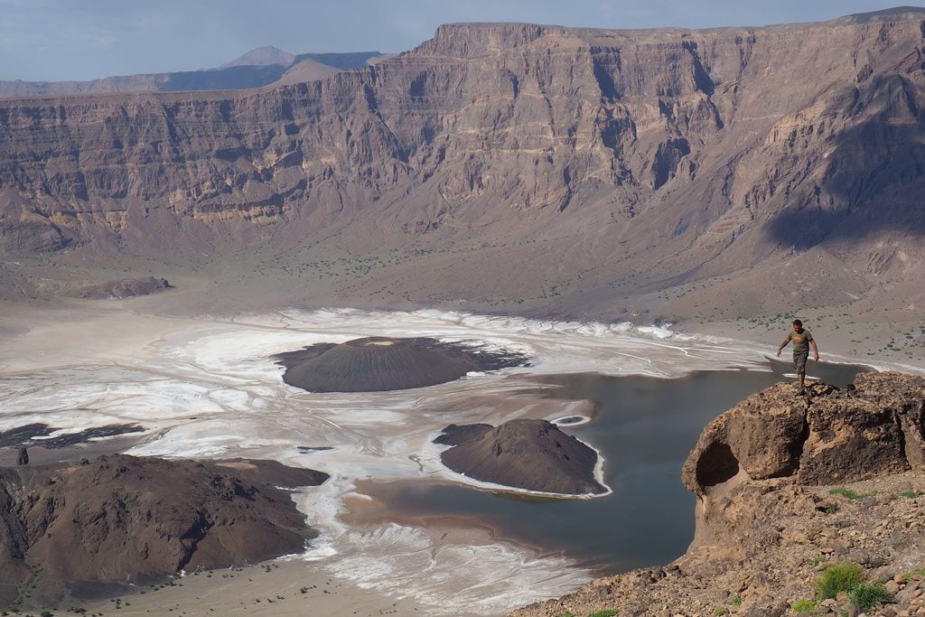
If you look at one of our drone photos, you’ll see a breathtaking 800-meter drop rising from the vast plateau.
The Trou de Natron caldera is 8 kilometers wide and 700 meters deep. The white patch visible at the bottom of the crater is natron (sodium carbonate), dissolved from volcanic materials by water that evaporates from intermittent rainfall.
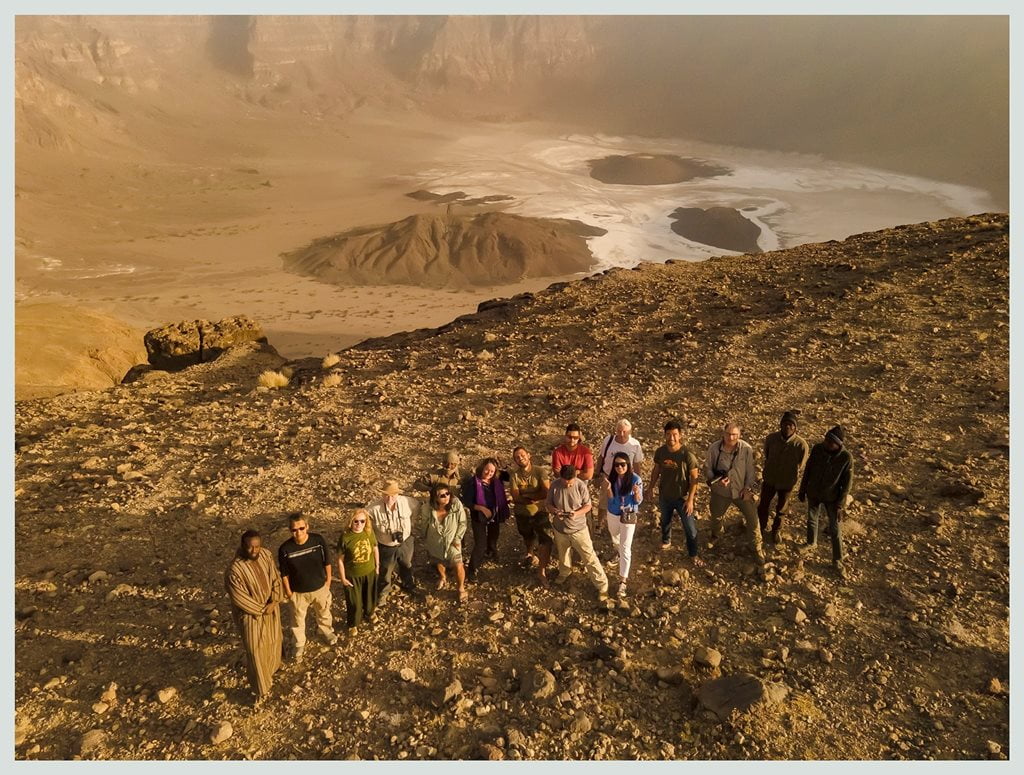
The Teda herders who live in these remote regions of the Tibesti descend with donkeys into the Trou de Natron, where they collect natron. They then grind it and mix it into the camels’ feed, supposedly to make them stronger.
Inside the Trou de Natron crater, we also find three spectacular dark ash cones rising from the white crater floor. One of them—the most impressive—is a perfect truncated cone 100 meters high. In the vicinity of these cones, there are hot springs that indicate there is still volcanic activity deep underground.
No one knows when or how the Trou au Natron was formed: whether it was created by a massive eruption, a collapse, or both. The deposits high up on the slopes suggest that it once contained a lake perhaps 500 meters deep—evidence of the dramatic changes the Sahara has undergone.

Descent into the interior of the Trou de Natron caldera
The descent and subsequent ascent of the Trou de Natron isn’t for everyone. Of the 12 travelers in our group, only 5 of us managed to complete the entire hike down and back up—and it wasn’t without its challenges.
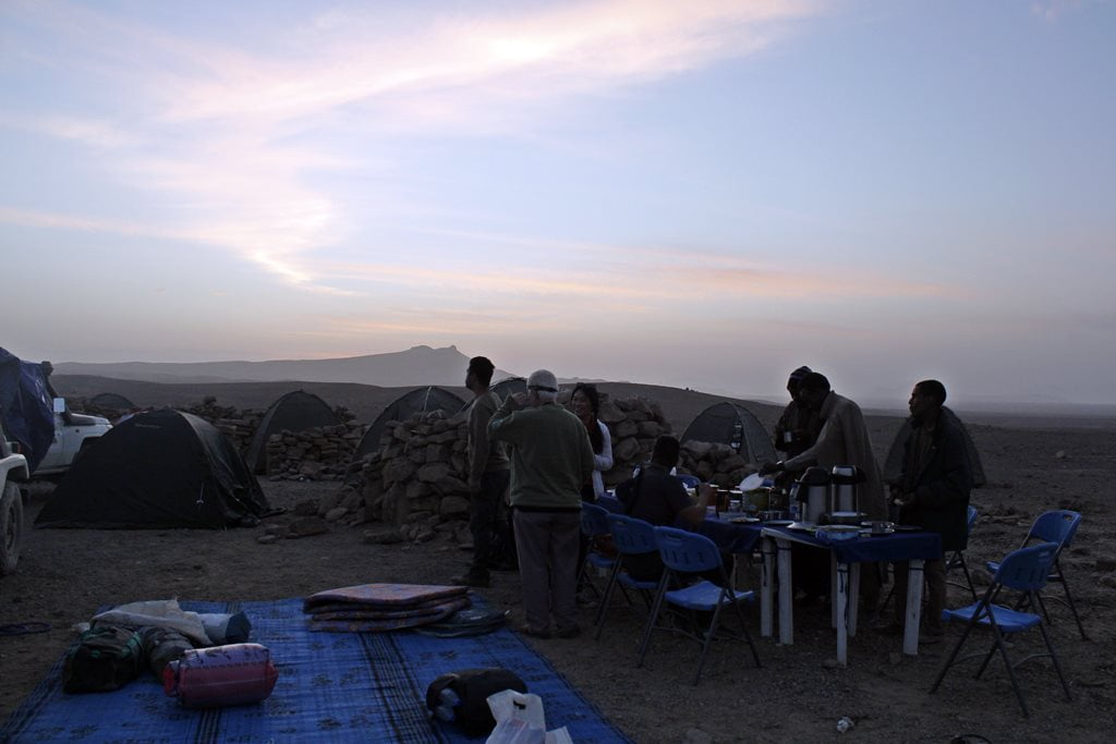
Very early in the morning, after breakfast, we left our camp, located at an altitude of 2,230 meters. Contrary to what we had expected, the night wasn’t particularly cold.

It took us about three hours to descend into the caldera along a narrow trail that winds along the colossal volcanic cliff. This trail was carved out by local shepherds who come here with their donkeys to extract natron. It’s a rugged trail that zigzags down a 785-meter elevation drop.
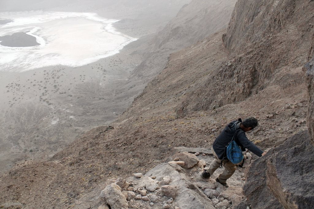
The descent isn’t particularly difficult since it takes place early in the day, when the heat and sun aren’t too intense yet. Once at the bottom, the sand and natron make it hard to move, and the heat begins to become relentless, so it’s best to pace yourself and take some breaks.
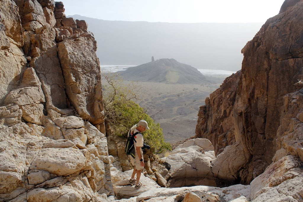

After a brief visit and with the long climb back ahead of us, we began our return journey under the blazing sun, which was exhausting. Perhaps it would be a good idea to spend the night down there and enjoy the hot springs at Trou de Natron.
Because one of our trip companions wasn’t feeling well, the climb took us a few hours longer than expected, and we arrived back at camp late in the afternoon. That said, we enjoyed a wonderful dinner of grilled goat and delicious mashed potatoes prepared by one of our female passengers.
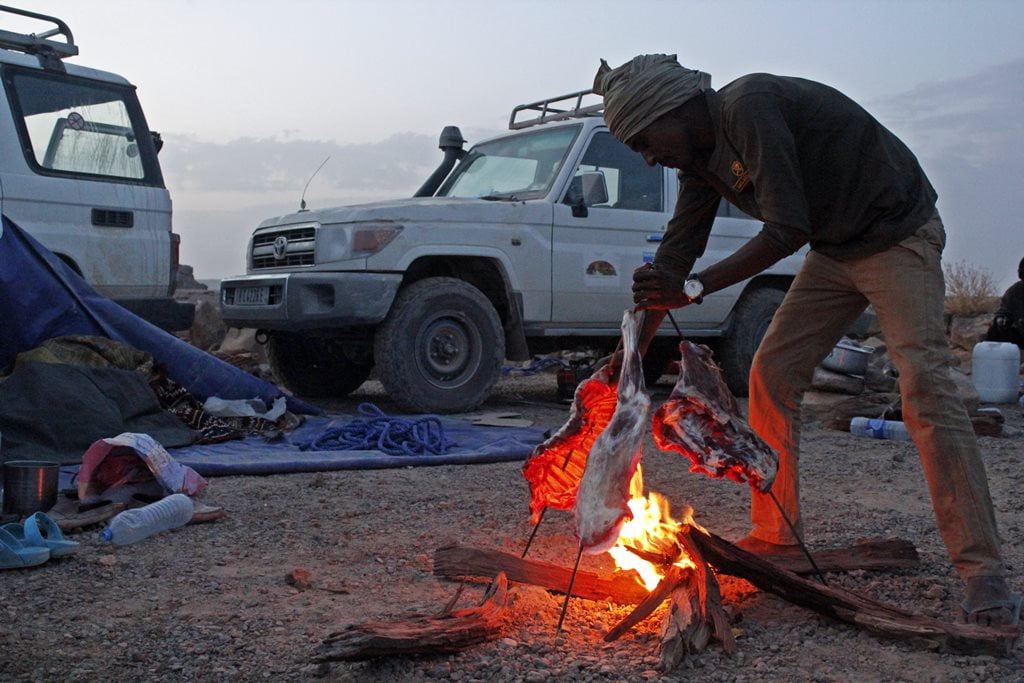
The route from the Trou de Natron to Bardai
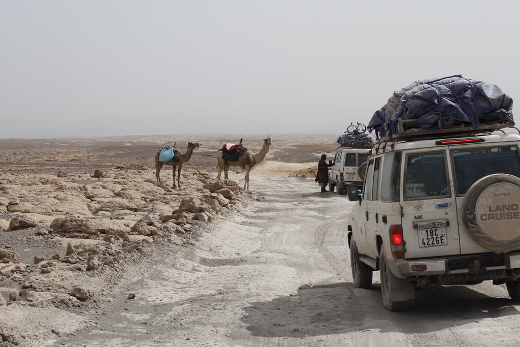
Once again, we continued our journey in our vehicles through an unusual, truly spectacular landscape. As would become the norm in the Tibesti, the trail—if you could even call it that—was a veritable hell that constantly tested the endurance of the vehicles, the drivers, and the passengers alike. Some travelers decided to stretch their legs and continue on foot. After all, we were moving at the same speed anyway.
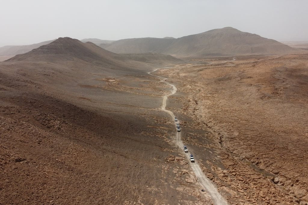
The Oudingueur Gorge
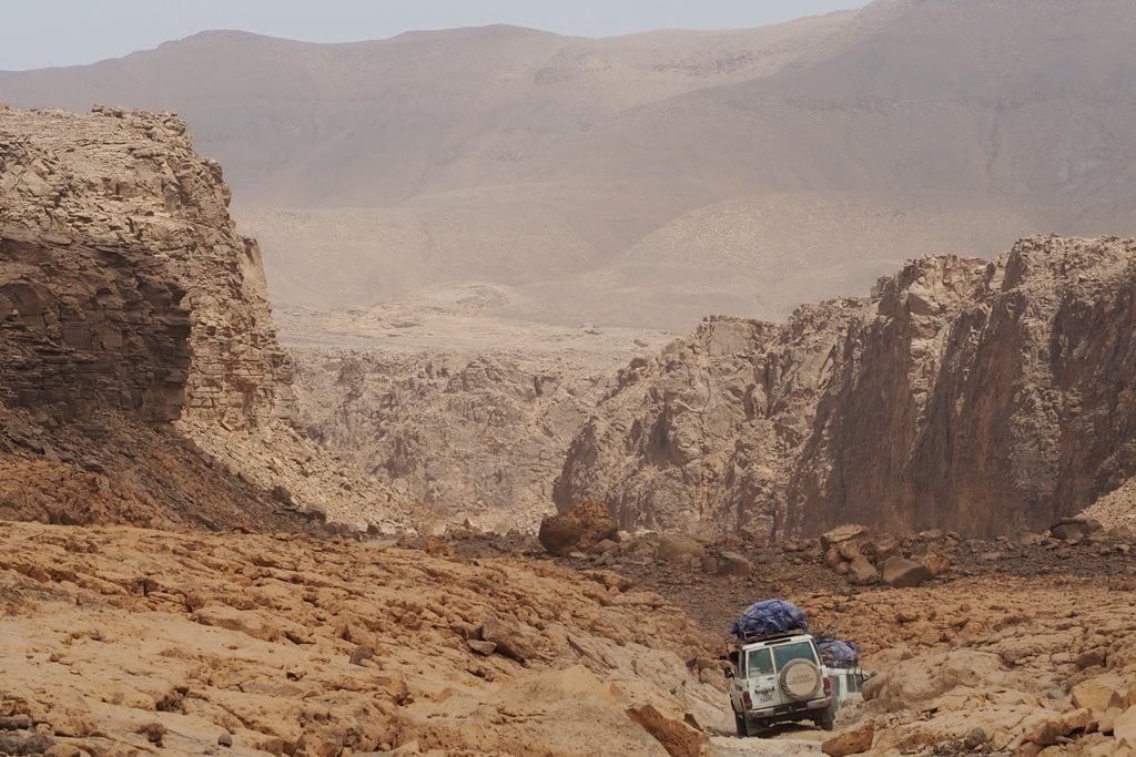
The route to Bardai, in the heart of the Tibesti, descends into the winding Oudingueur Gorge. The track barely manages to wind its way through the gorge.
The Enneri Oudingueur is one of the main underground watercourses in this part of the Tibesti. These waters have carved a narrow gorge between the sandstone walls and the fields of volcanic rock. In the Oudingueur Gorge, just as in the Zouar Canyon, the Gonoa Valley, or the Bardai Valley, there are numerous rock art sites, making it a true paradise for any art lover. We decided to stop at the Gonoa site, the most important in all of Tibesti.
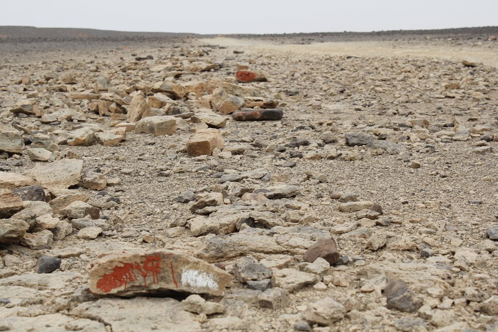
More than 30 years have passed, and certain areas of Tibesti are still dotted with stones painted red and white (red for mined areas, white for safe areas) that indicate the presence of landmines laid during the various wars and conflicts in the region. There are several sections along this route—from Trou de Natron to Bardai—where we find these signs marking mined areas alongside the trail.
Site of Gonoa, rock art in Tibesti
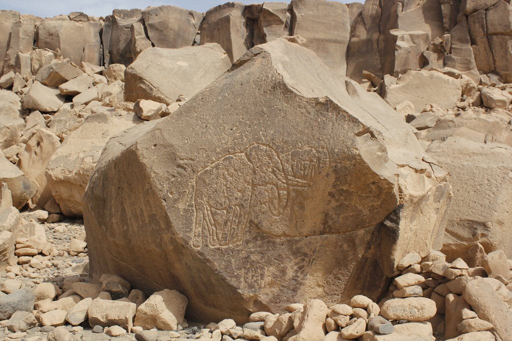
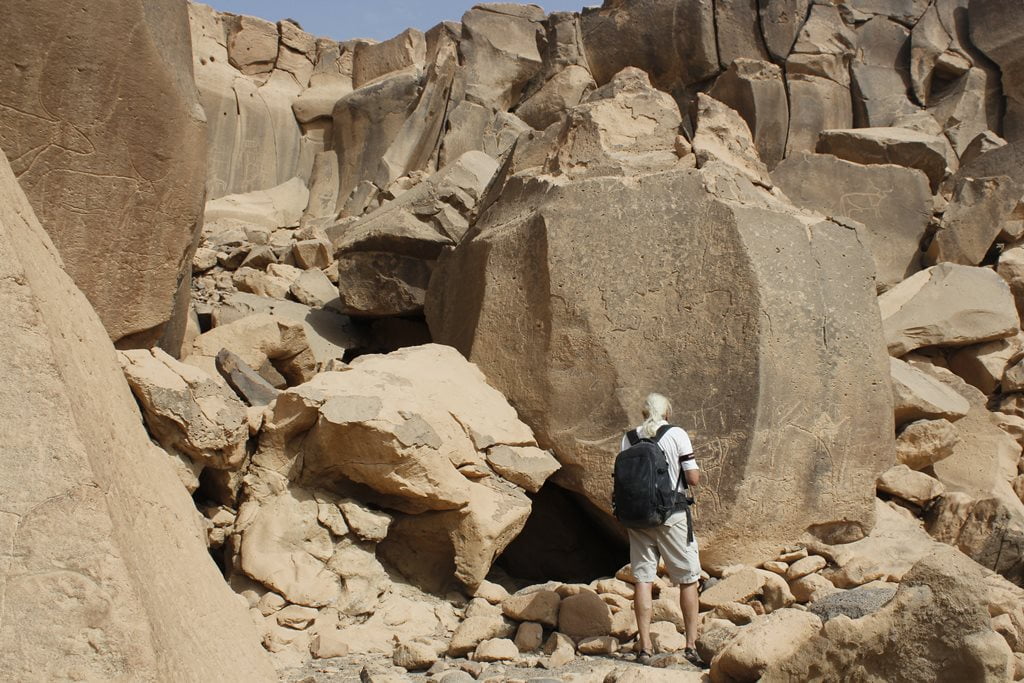
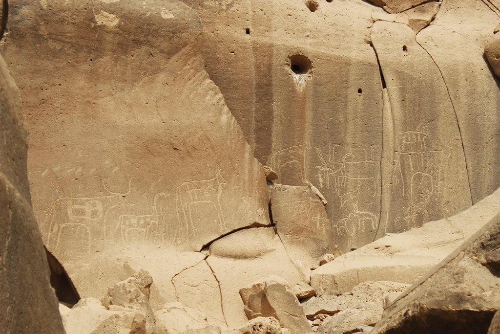
The Gonoa site consists of more than 700 engravings from different periods. Of all these engravings, the famous “Man of Gonoa” is the one that has sparked the most curiosity.
This engraving depicts a “masked hunter” nearly two meters tall. The hypothesis is that the “hunter period” in Gonoa began around 5000 B.C.

The subjects depicted on the rock walls of Gonoa include wild animals such as elephants, giraffes, and rhinos, as well as domestic animals. There are also human figures. In Tibesti, there are countless sites with rock engravings. Any stop along the route where there are rocks reveals a large number of examples of rock art.

Bardai, capital of Tibesti
Inhabited since ancient times and later used as a military base, the thriving town of Bardai is situated in a spectacular setting at an altitude of 1,000 meters, nestled among vast palm groves and dramatic rock formations.
This imposing river valley is the only one with a more or less significant date palm cultivation and a substantial permanent population, along with Zouar, Yebbi Souma, and Yebbi Bou. In fact, in Bardai, one can find the occasional housing development and even a few multi-story buildings—presumably for high-ranking officials and major merchants.
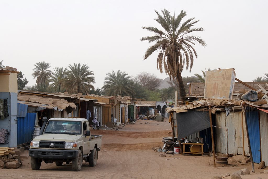
The well-stocked shops and stalls in Bardai are full of products from nearby Libya, which is much more accessible than the Chadian capital. Bardai is a very pleasant place to stroll around and get to know the people of Tibesti. It’s even a good spot to have a beer—believe it or not, they actually get them here. That said, they cost about 5 euros a bottle.

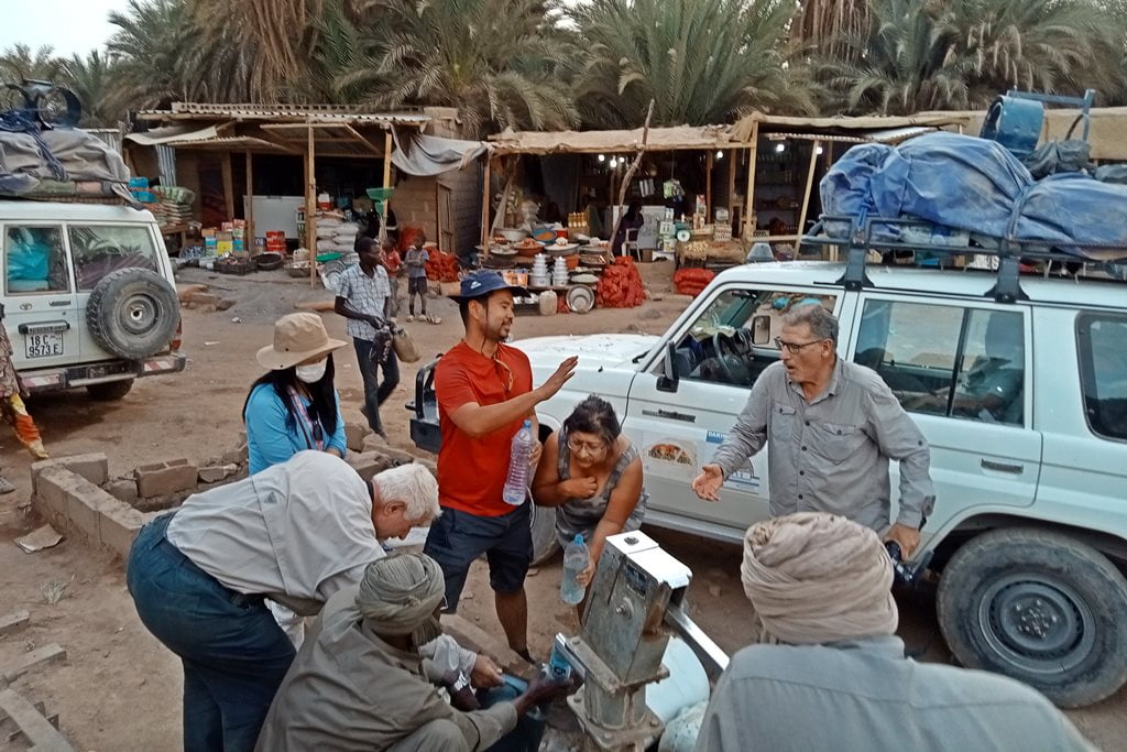


Contrary to what one might imagine, the inhabitants of Bardai are extremely friendly and always greet us and invite us to take pictures, which is unusual in northern Chad.
The area around Bardai invites you to lose yourself there for several days. Wherever you look, you’ll see beautiful rock formations, canyons, and palm groves. However, since this is an area that has historically been complicated and strategic during past wars—and therefore one where the ground may have been mined—we prefer not to stray too far from the city when setting up camp.

Enneri Zoumri and the Desert Oases
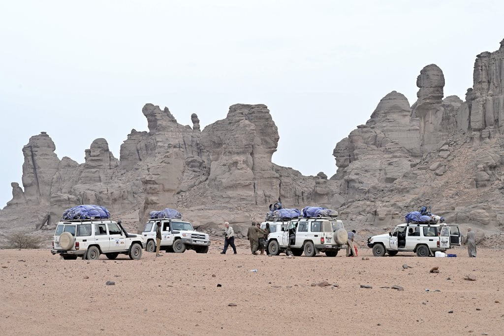
After leaving Bardai, we entered the Enneri Zoumri or Zumri Valley. Here we found beautiful landscapes dotted with traditional Teda villages and oases of radiant green.
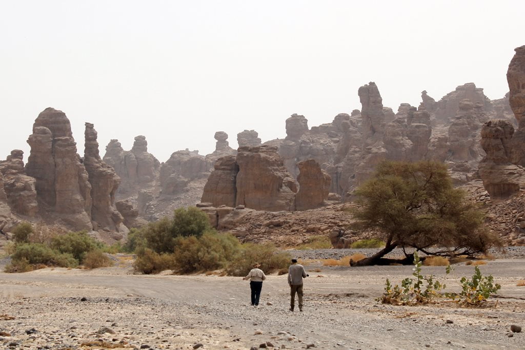
This time, the trail winds through imposing sandstone gorges where we stop to walk and take pictures. Once again—and as would be the case throughout the trip—the harmattan made it difficult to see and hindered any kind of walking. This harmattan was stronger and longer-lasting than usual, and in those very same weeks it would reach Europe, blanketing the continent in dust.


The Teda of Tibesti: Nomadic Peoples, Gold, and Conflicts
The Teda People and Their Adaptation to the Mountains of the Sahara
After passing through the Zoumri Gorge, we arrived at the town of Yebbi Souma. Once again, the landscape became rugged, desolate, and harsh.
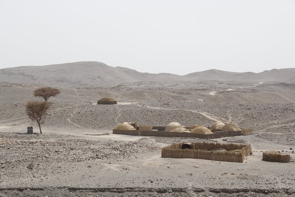
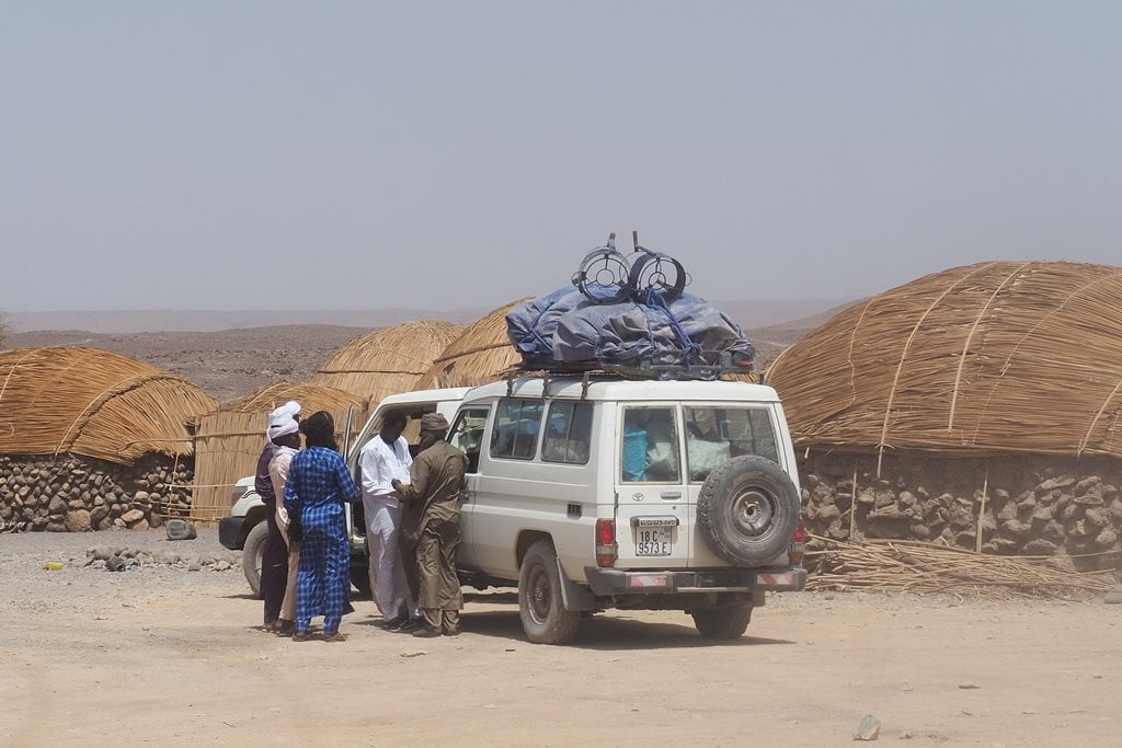
The traditional Teda structures in this part of the Tibesti consist of circular stone houses with roofs made of branches. We also find some exceptional examples of rock formations featuring numerous basaltic columns.



Unlike Bardai, which is just a few hours’ drive away, the atmosphere with the local population began to feel different—especially with the local leaders. After some negotiations and a few disagreements in the town of Zoumri, we continued our trip to Yebbi Souma, located next to a spectacular cliff.
Beyond Zoumri, the Chadian government has little say. In a region as remote and rugged as this one, it is very difficult—if not impossible—to maintain control over the territory if its inhabitants turn against it.
Unlike in other parts of the Sahel and the Sahara, the conflict here has nothing to do with religious fundamentalism. In fact, terrorists are widely despised in this region and throughout Chad. This is a unique problem faced by a people who feel independent and want to control their own natural resources.
The Gold Rush and the Self-Defense Militias
The inhabitants of Tibesti are known as Tubus ( the people of the Tibesti). Today, the word Tubu or Toubou (in French) is used to refer to most of the inhabitants of northern Chad (Ennedi, Bourkou, and Tibesti). Specifically, the inhabitants of Tibesti are predominantly of the Teda ethnic group. Their societies are based on patrilineal clans, which share the oases, pastures, and wells.
The Tubus are an ethnic group that lives primarily in northern Chad, but also in southern Libya, northeastern Niger, and western Sudan. Although they have traditionally been herders and nomads, many in the Tibesti region are now involved in the gold trade.
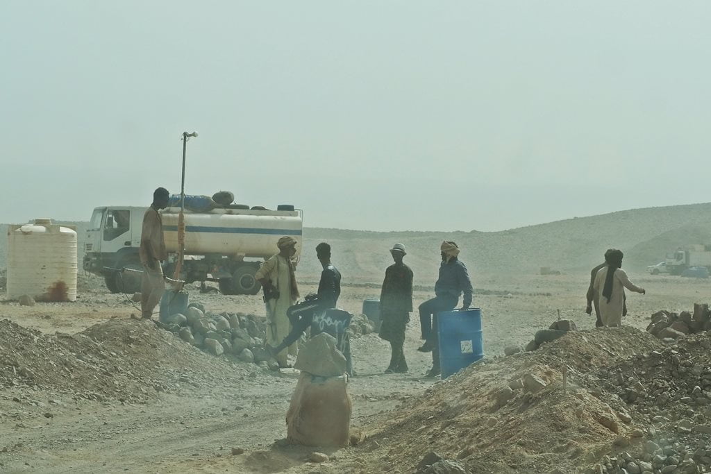
The harsh life of nomadic herders, coupled with a shortage of pasture and water, has led many residents of Tibesti to trade their herds of dromedaries for 4×4 trucks, satellite phones, and all the equipment needed to mine gold in artisanal mines.
As a direct result of the extremely harsh geographical conditions in which they live, the Tubus are individualistic, tireless people with a fierce and indomitable spirit.
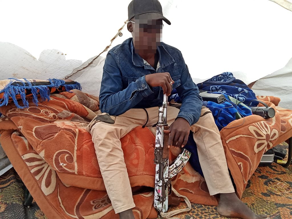
This indomitable spirit of the Teda people of Tibesti has led them in recent years—after gold was discovered in the region—to form self-proclaimed self-defense groups, which, according to some of their members, do not consider themselves either Chadian or Libyan. These militias control access to the mines and strategic enclaves in Tibesti and have been causing the central government of Chad many headaches for years.
We encountered these militias on several occasions; some were friendlier than others, but they always caused uncertainty and nervousness among us, so we decided to change our original trip itinerary to avoid all the checkpoints at the Minski gold mines.

What’s happening in Tibesti?
During your trip through these troubled lands and as you begin to understand the root causes of these “rebel” groups, you may find yourself feeling a certain empathy toward them.
Since 2012, the gold boom in the region has attracted traders, thousands of miners from central and southern Chad and other neighboring countries, soldiers and deserters from the Chadian army, and Chadian and Sudanese rebels, all seeking to capitalize on the unexpected and quick profits offered by gold mining.
Pollution caused by mercury-based artisanal mining, the lack of infrastructure throughout Tibesti, and a Chadian government that is unable to guarantee even basic services to its citizens have led to the self-defense militias receiving the full support of the local Teda population.
Resource control and management: the perennial problem of the African continent
Recently, tensions have been rising from time to time in the gold-mining areas of Tibesti between the Chadian government, the miners, and the local Teda population.
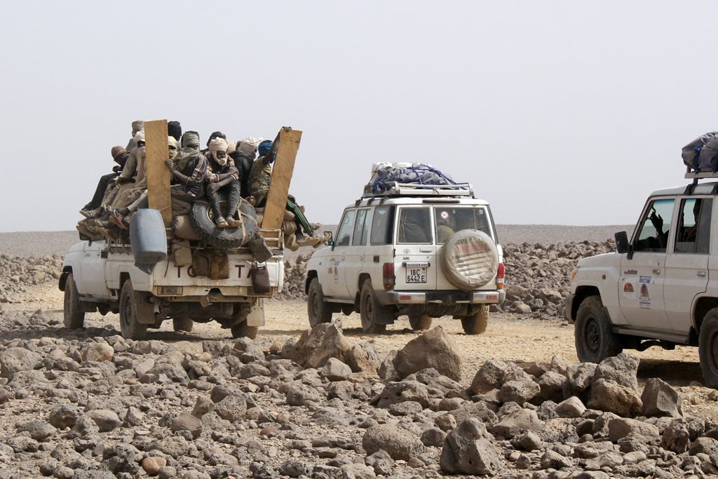
The massive influx of outsiders drawn by gold (we came across quite a few pickup trucks loaded with miners), the growing militarization of the region, and the deep mistrust of the Teda people toward the central authorities have contributed to the recent conflicts in Tibesti.
Yebbi Souma and Yebbi Bou: The Change in Course of Our Expedition
As we approached the Miski region— a mining area par excellence—passing through Yebbi Souma and Yebbi Bou, these tensions were particularly evident at the checkpoints manned by self-defense militias. This was especially true in Yebbi Souma, where, after visiting the spectacular Enneri River that flows past the small town, we came across a large militia checkpoint.
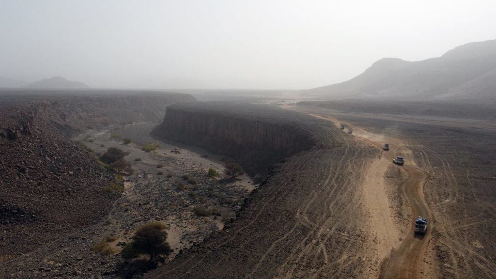
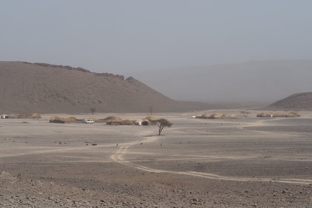
The negotiations caused us to make slower progress than usual that day, so we had to set up camp in a desolate area, exposed to the winds and at an altitude of nearly 2,000 meters.
Once again, we were facing a difficult night. Being exposed to the winds meant that the cooks would have a hard time doing their jobs, that everything—including the tents—would be blown away, and that the night would be a long one indeed. Did we mention this was a great adventure? This is Tibesti!

The village of Yebbi Bou, with its many traditional-style houses, is located on a steep cliff. In the depths of the valley is a lush palm grove and a small stream.
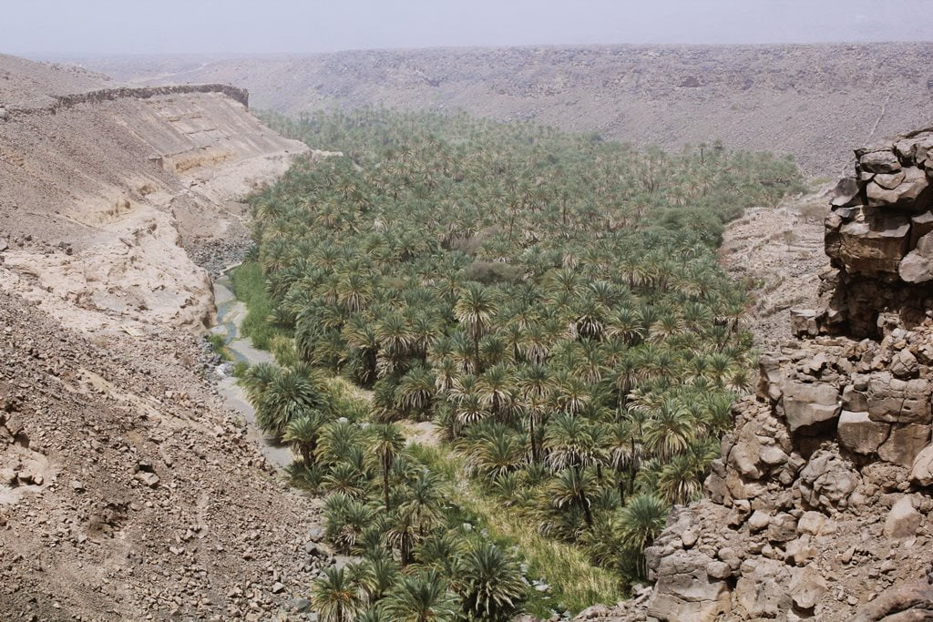

The ancient settlements of Yebbi Bou and Yebbi Souma were located in the interior of the valley, but their inhabitants chose to settle on the upper part of the impressive geological fault.
After introducing ourselves to the local authorities and discussing the conditions of the road to Miski and Emi Koussi (south), we decided to radically change our original plan and continue on to Gouro (east).

Eastern Tibesti: Into the Unknown
This change of plans meant that none of us—including the local team—had traveled along the new route before, and that we would have to figure out the route as we went along.
As soon as we left Yebbi Bou and its small airstrip (used as a local airport) with an old, crashed airplane, the road—if you can call it that—became indescribably difficult. Once again, we had to navigate some rocky mountain passes at an altitude of over 2,000 meters, circling the Tarso Guezendi volcano—trails more suited for goats than for 4x4s. That said, it was undoubtedly worth the effort. The view was spectacular.


The new route offered us the most breathtaking volcanic landscapes we had seen so far, while also posing a constant challenge to the drivers, who had to demonstrate their best driving skills with every meter we traveled.
The breathtaking panoramic views unfolded one after another around every bend until, late in the afternoon, we began descending the rocky trail to a large plateau known as Brague. With the last rays of daylight, we decided to spend the night next to a small valley at an elevation of 1,800 meters, the only possible shelter from the wind blowing in the area.
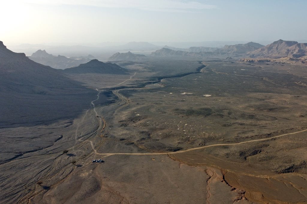
This change of plans had worked out perfectly for us. We were all tired but very excited about the new and impressive route. We didn’t know that an even more impressive day—if that was possible—awaited us the next day.

Tassili Kezen, the Tibesti dream landscapes
The Brague plateau is the transition between the volcanic landscapes of the steepest mountains of Tibesti with the most beautiful fantasy scenes formed by cliffs, sand and sandstone rock.
Early that morning, we still had no idea what an incredible surprise we were about to witness.

The trail became somewhat more passable and began to descend across a plain of black volcanic rock until it reached a cliff that revealed what lay ahead of us: the Tassili Kezen, the most breathtaking landscapes of the Chadian Sahara. A sea of sand and dunes dotted with the most striking rock formations.
To our right, thanks to the Harmattan dust giving us a break early in the day, we could make out the silhouette of Emi Koussi, the highest peak in the Sahara at 3,445 meters.

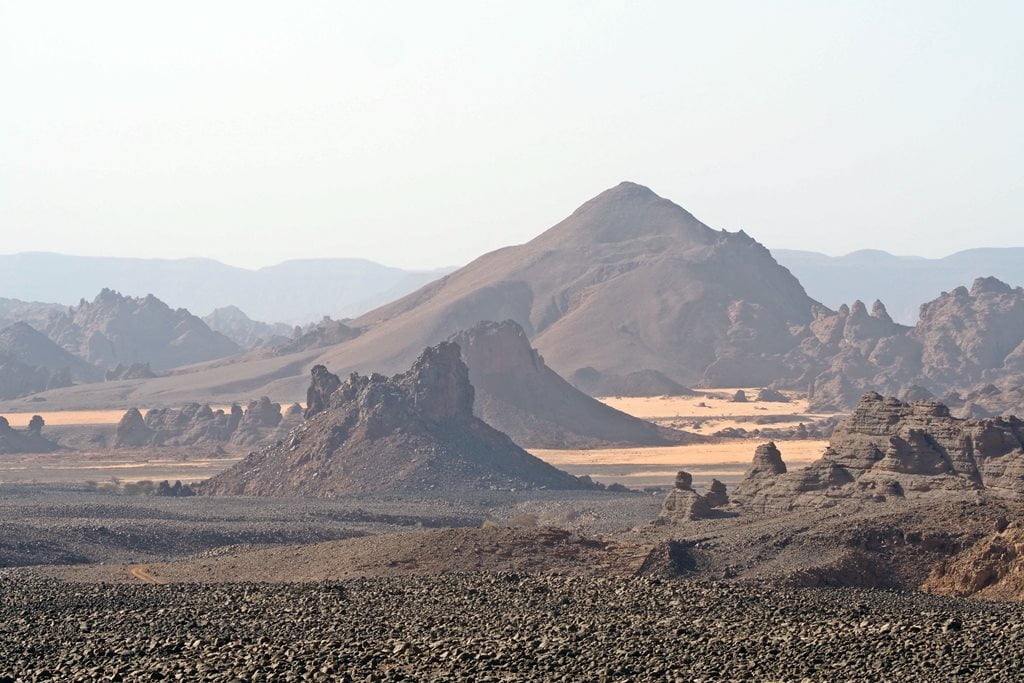
A large sandstone ridge cut through two spectacular dunes, while connecting two enormous mounds of dark rock. This ridge offered the most spectacular vantage point imaginable from which to gaze upon the vast Tassili Kezen.
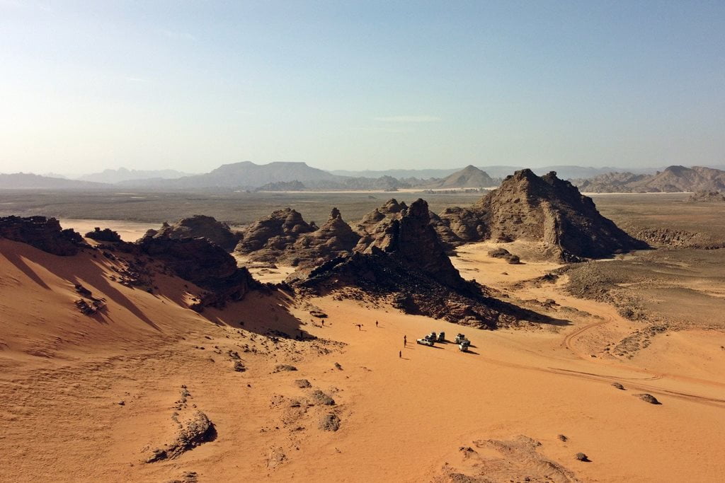
Throughout the day, we explored the fascinating Tassili Kezen, stopping every few steps to take pictures and venturing at random into breathtaking canyons that seemed to be the eastern foothills of Emi Koussi. The color of the sand gradually changed from gold to white, ending in red dunes at the far end of the Tassili.

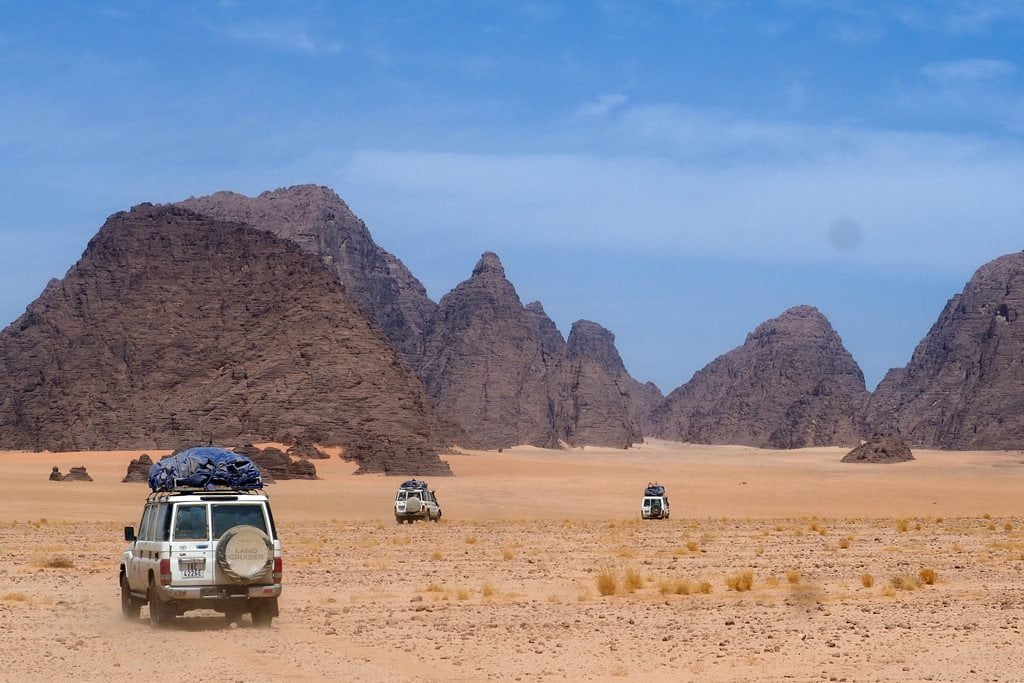


Ouadi Drosso and the exit from the Tibesti Massif
We continued our trip, slowly descending from the Tassili Kezen plateau toward Gouro, first through the Ouadi Magan and then through the Ouadi Drosso. Once again, a few villages began to appear along our route, and with them came the opportunity to refill our meager water supply from a well.
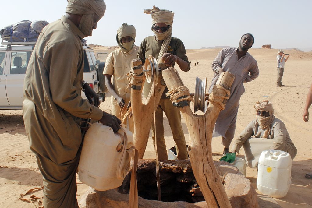
Not far from Bini Erda, we took a break at the Muioyanga well, where we ran into a group of gold prospectors, with whom I had an interesting conversation about the gold business in the Tibesti region.
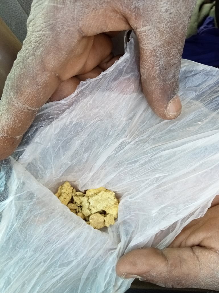
Gouro, an oasis nestled between dunes and cliffs
Our arrival in Gouro was once again spectacular. From the military checkpoint, we could see the beautiful town nestled beneath impressive dunes and cliffs, in the middle of a vast palm grove. After spending the night there, we would have the opportunity to explore the town in depth.
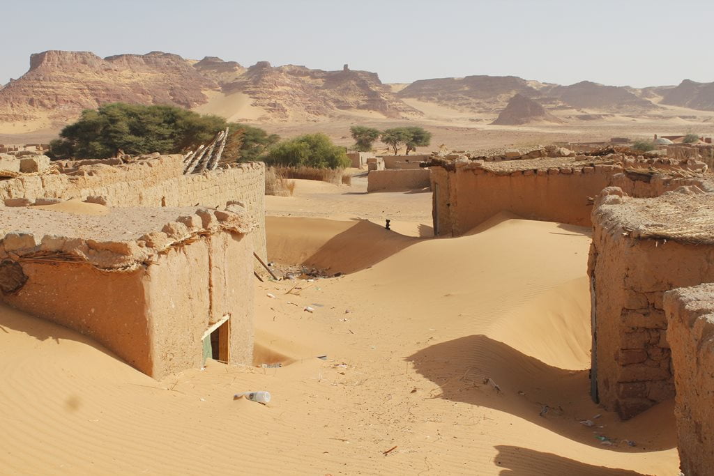
The town of Gouro, strategically located along the routes from Ounianga to Kufra (Libya), Tibesti, and Faya, has long been suffering from depopulation. Unstoppable desertification and the search for a better future in Libya or Ndjamena have left many of their homes buried in the sand.
With just enough diesel to get to Ounianga Kebir, we set out on our next trip.

The Return to N’Djamena: The Ounianga Lakes and Desert Caravans
Ounianga Kebir and the Desert Lakes
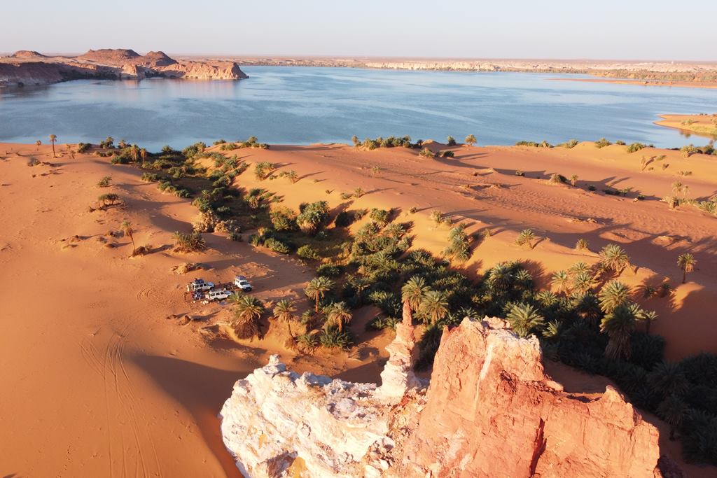
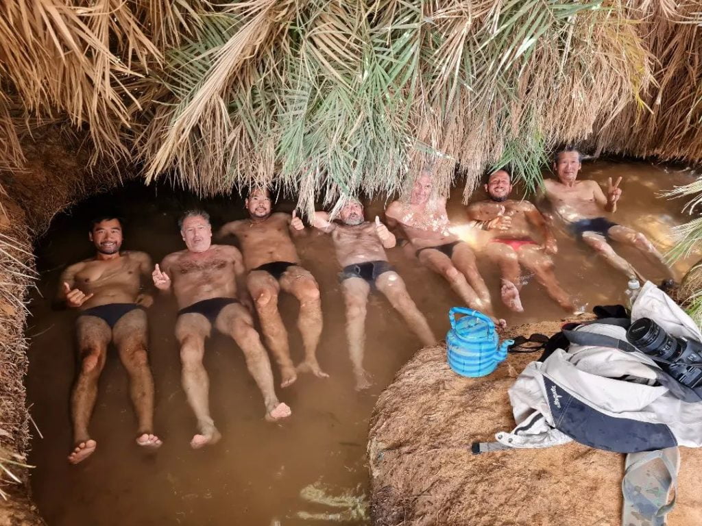
The town of Ounianga Kebir, with its stunning lake surrounded by dunes and palm trees, marked our return to an area that was well known to me and the local team. All that remained was to head back to Ndjamena—a long journey of several days, but an equally interesting one. Before setting out on the return trip, we enjoyed a wonderful swim in a natural spa—it was about time!
The Caravan Route and the Well Route
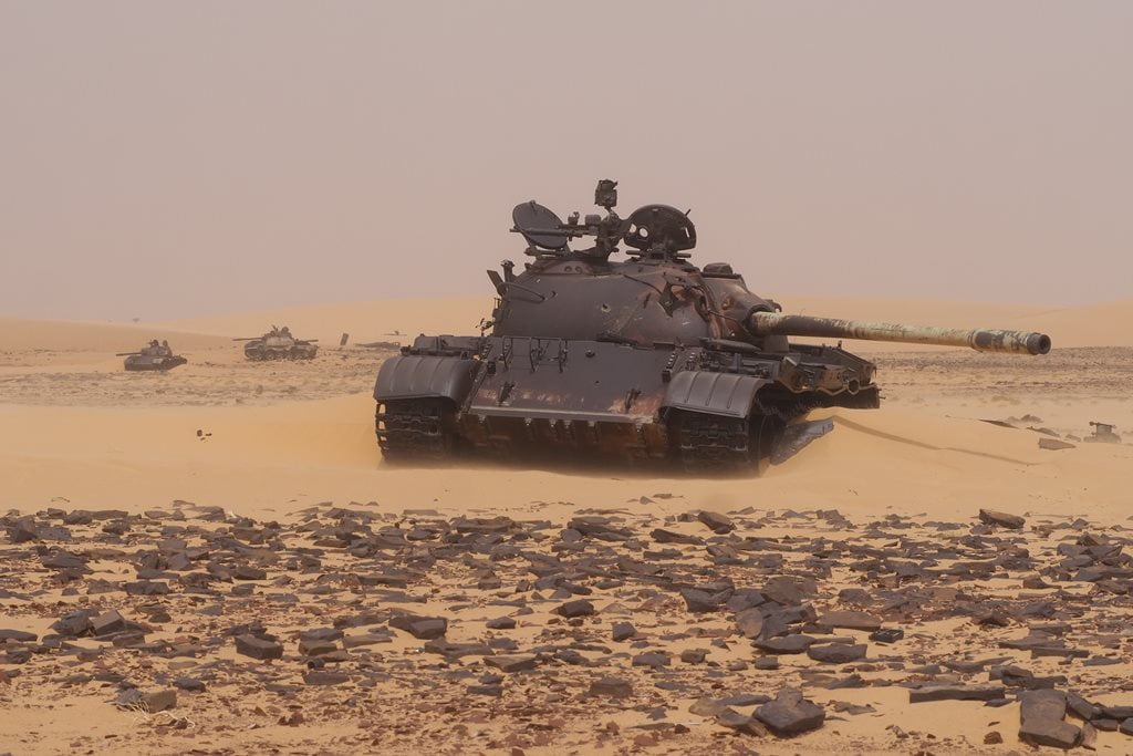
Along the caravan route, we come across an extraordinary concentration of abandoned rockets, bazookas, tanks, jeeps and trucks—all remnants of the war with Gaddafi’s Libya. In addition, if you’re lucky—as we were—you’ll have plenty of chances to come across some of the salt caravans traveling back and forth from Wadi Dum. We later went on an expedition to accompany one of these salt caravans; you can read the story here.
After our encounter with the Azahawa nomads, we continued our trip along the waterhole route to meet Arab and Daza nomads, whom we also encountered at some of the numerous waterholes along the way.

The large herd of elephants at Lake Chad
To wrap up our trip, we headed to the Lake Chad basin in search of the large herd of elephants we had seen on a previous trip.
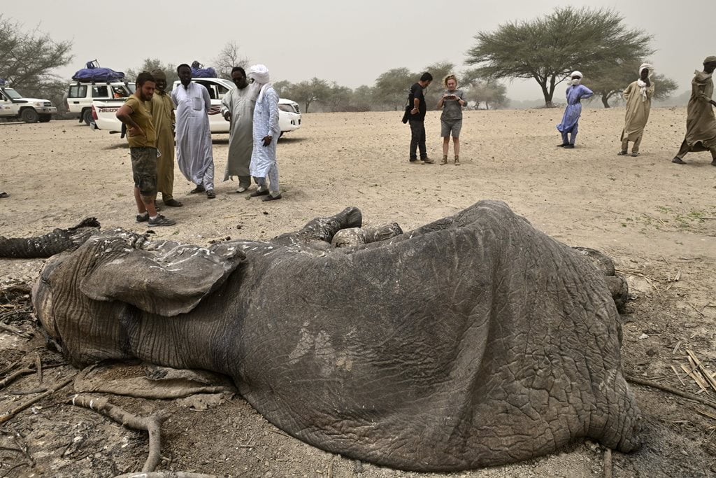
This time luck wasn’t on our side, and we were only able to see a group of about 10 or 15 elephants from a great distance. Around that time, the elephants had ravaged a village, and the local population had attacked one of the most aggressive elephants (killing it with authorisation from the Chadian government). As a result of these events, the large herd of elephants had split into two groups and were acting nervous and skittish.
The Lake Chad region is a grazing area for various nomadic groups, including Arabs, Fulani, Kanembeu, and others. After spending the night in a large semi-nomadic camp of the Weila Fulani, we returned to N’Djamena, where a nice hotel with a pool and a good night’s rest awaited us.
You can read more about Lake Chad here.

Travel to Chad with Kumakonda
If you’d like to take a trip to Chad with us, you can contact us at info@kumakonda.com or check out our scheduled group expeditions in the “Trips” section of this website, where you’ll find trips to experience the Gerewol festival of the Wodaabe, expeditions across the Ennedi Plateau, or to Lake Chad and the southern part of the country in search of its tribes.

Autor:
Austerio Alonso
Co-founder of Kumakonda. Passionate of Africa. Specialist in the design, preparation and realization of expeditions in Africa. Content creator.
Travel with us