


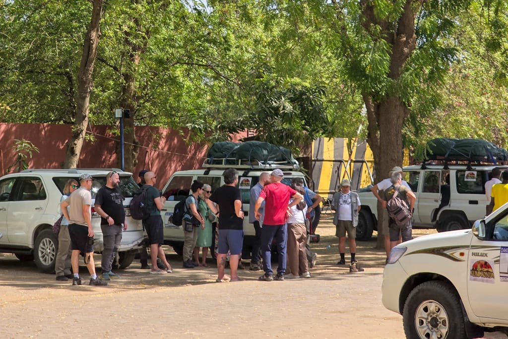
After four years without traveling to Tibesti, in January 2026 we returned to explore the most remote region of the Sahara Desert. The expedition consisted of 17 international travelers, 6 drivers, 6 4×4 vehicles, and 3 cooks.
This time, the expedition went smoothly and without any incidents involving the rebels following the peace agreements. We also enjoyed magnificent weather with blue skies and no wind.

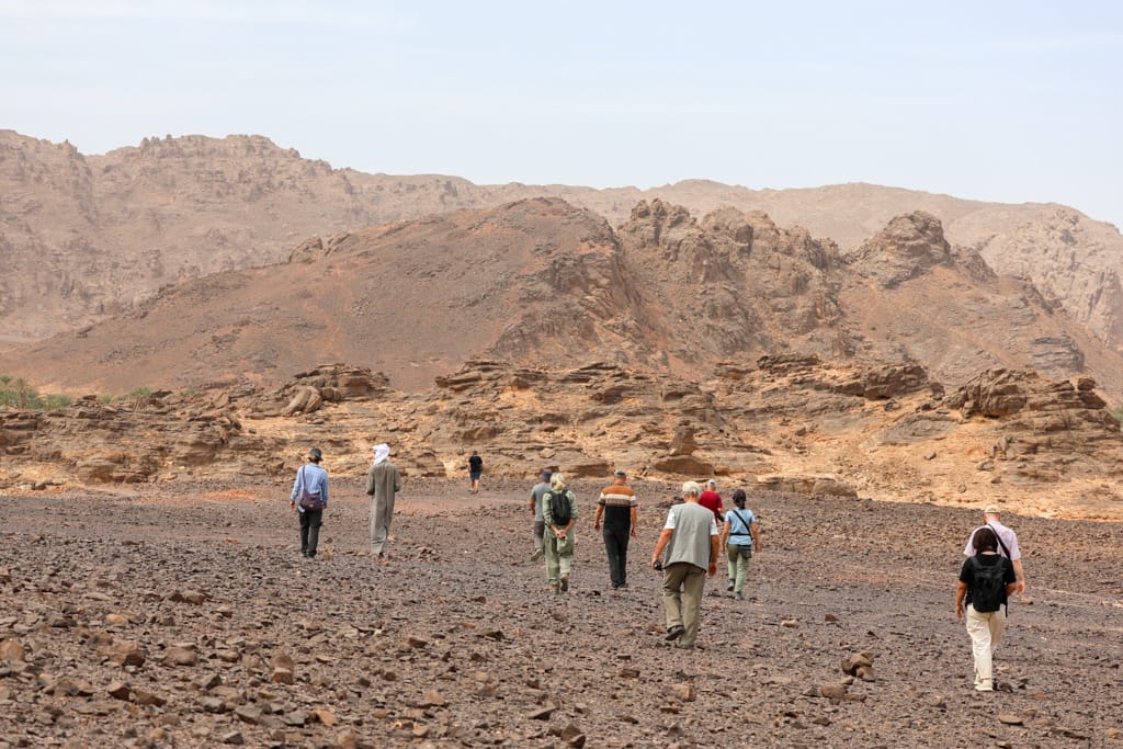
The Tibesti Mountains are one of the two main mountain ranges of the Sahara, along with the Algerian Hoggar. Tibesti is an isolated volcanic cataclysm, composed of mountains of rough and bare rock, endless plains of stones, rivers of lava, sandstone cliffs rising precipitously from the ground, unlikely rock formations, sandbanks, lush oases turned into real wonders of nature and winding and winding tracks.

Although it is true that some roads have been repaired and travel is a bit faster now, the Tibesti remains the most remote and inaccessible part of the Sahara and one of the most isolated regions on the planet.
Known as the “Roof of the Sahara” for its volcanoes towering over 3,000 meters and its breathtaking volcanic craters—such as the Trou de Natron—the Tibesti volcanic labyrinth offers a breathtaking trip experience.
Travel to Tibesti
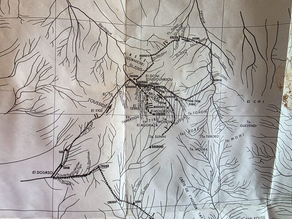
More than 1,200 kilometers from the capital, N’Djamena, in the isolated northwest of Chad, bordering Libya and Niger, lies the spectacular Tibesti, a remote volcanic mountain range 380 km long, which is the least-visited part of the Sahara and, of course, the least known. On this 21-day trip, we crossed the Tibesti from west to east, entering from Zouarque and exiting via Gouro and Ounianga Kebir.
Very difficult to access and subject to travel restrictions, Tibesti was a forbidden region for long periods of time due to its wars and conflicts and off-limits to all travelers.

Today, the Tibesti rebels signed peace agreements in 2025 with the Ndjamena government and can be visited with due caution and always with an open mind to change plans. We do not know how long this can last, so we encourage the reader who has an interest in visiting this remote part of Africa to join one of the last real expeditions left on our planet.


Mountains of Tibesti, the roof of the Sahara
The Tibesti region is home to the highest peaks in the Sahara, including Emi Koussi (3,445 m), Pico Toussidé (3,313 m), Tarso Voon (3,100 m) and Tarso Toon (2,625 m). Once you ascend to the Trou de Natron from Zoua, the average altitude of the route through Tibesti is around 1,300 – 1,500 meters of altitude.


The landscape of chaos
Totally desolate and impressive lunar landscapes, inhabited by the feared Teda (mountain people), rough and untamable. All this accompanied by an authentic “atmosphere” of gold fever that makes this region a true last frontier.

Scattered throughout Tibesti are countless sites of engravings and cave paintings, which with their clear images tell us about the severe climate change that the region has undergone.


Our Trip to Tibesti, 2026 Expedition
Leaving N’Djamena, the capital of Chad, the asphalt disappears in the first hours of the journey. Beyond awaits some 3,500 kilometers of travel through sand, gravel or rocky tracks. After leaving behind Masaguet and Massakory, cities well connected by asphalt from the capital, the route takes us to Mao, capital of the sultanate of Kanem – Bornou. In these first days of travel we can enjoy the typical architecture of the Kanen and the meeting of some Arab salt caravans.


Mao has a medieval and historic atmosphere unlike that of almost any other city in Chad. Its impressive market is magnificently well-stocked with goods from Libya, Ndjamena (Cameroon), Niger, and Lake Chad. As is customary, we went to greet the Sultan of Kanen, but he was not there. We enjoyed strolling through its bustling streets, teeming with shops and life. Mao is undoubtedly one of the most interesting towns in Chad.


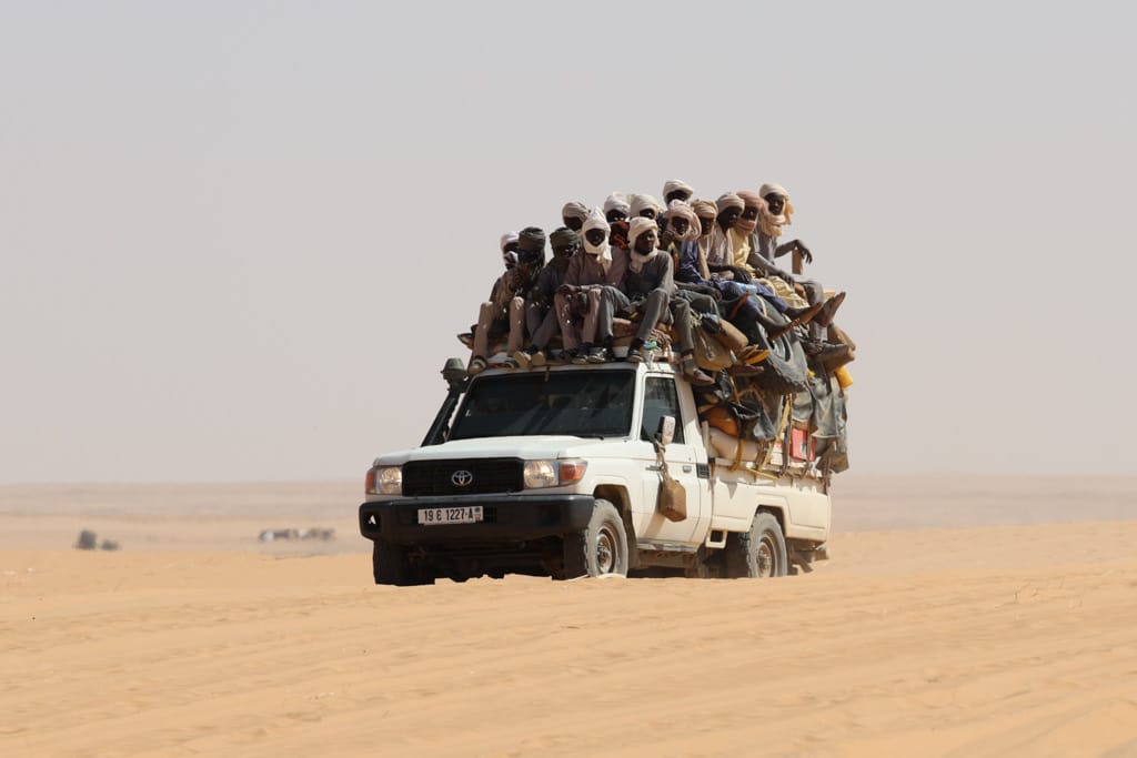
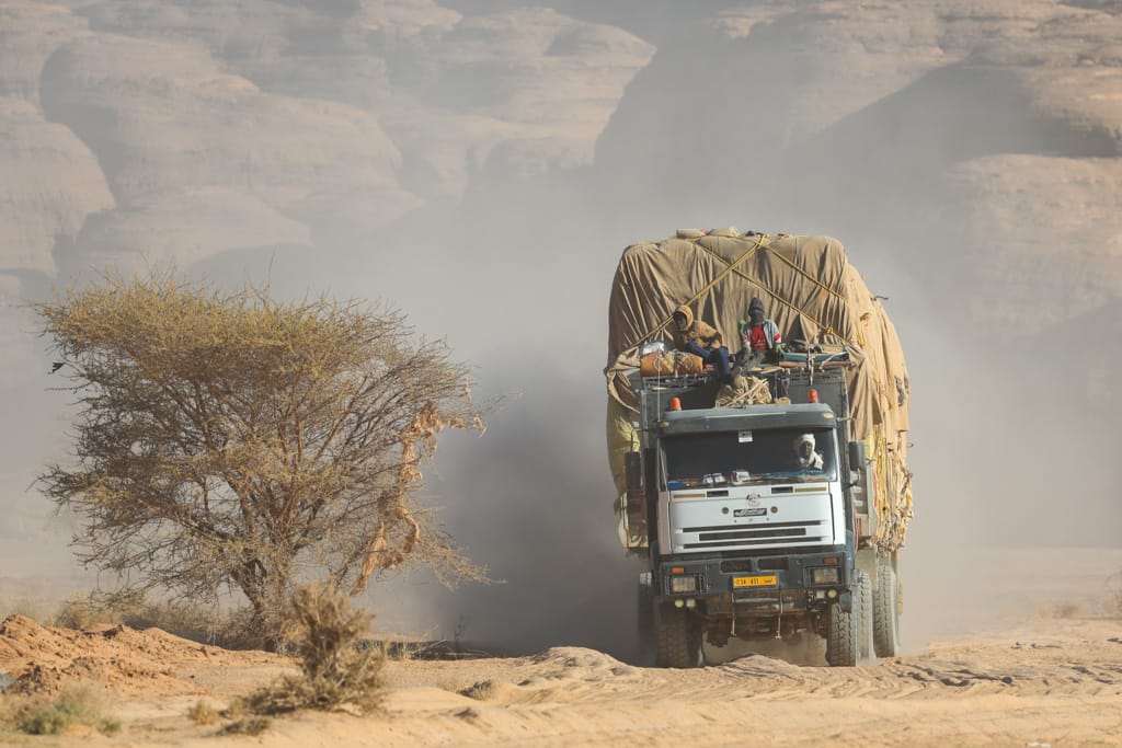
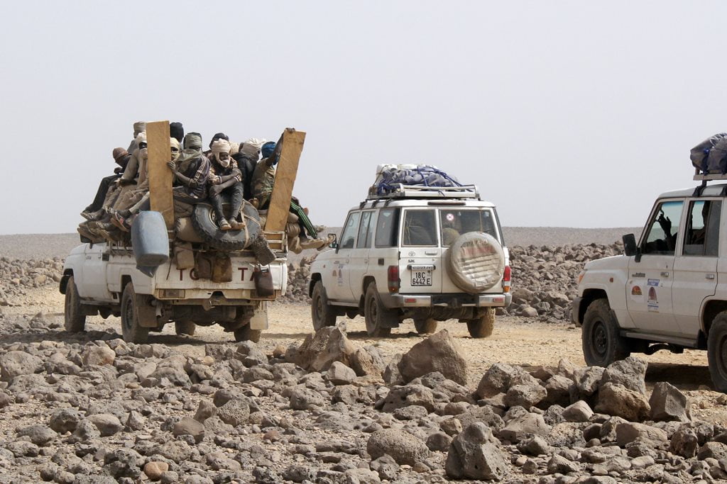
In this region of Kanem, especially along the route from Mao to Libya, you can see the iconic sight of old Mercedes trucks loaded to the brim with goods from Libya, with dozens of passengers piled on top.
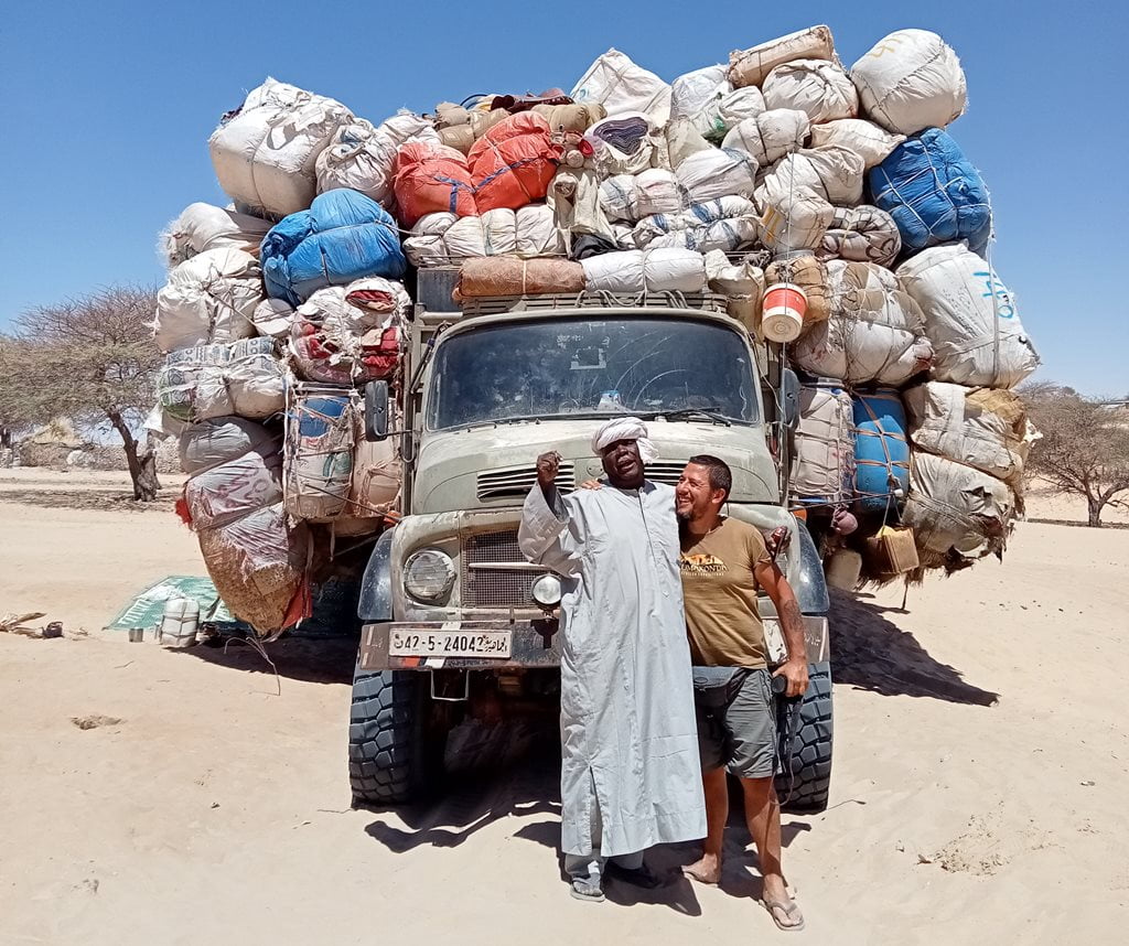

Along the border with Niger
From Mao the track leading to Tibesti becomes difficult and inhospitable and winds its way towards the border with Niger. There are very few vehicles that we come across in this remote part of Chad, only a few trucks carrying passengers and goods coming from Libya.

The long desert crossing
The Sahel gradually gives way to the desert plains of the Sahara. Little by little, the trees disappear, and so do the villages. Sometimes we get stuck in the sand, and the drivers adjust the tire pressure to suit the new conditions of the sandy roads.
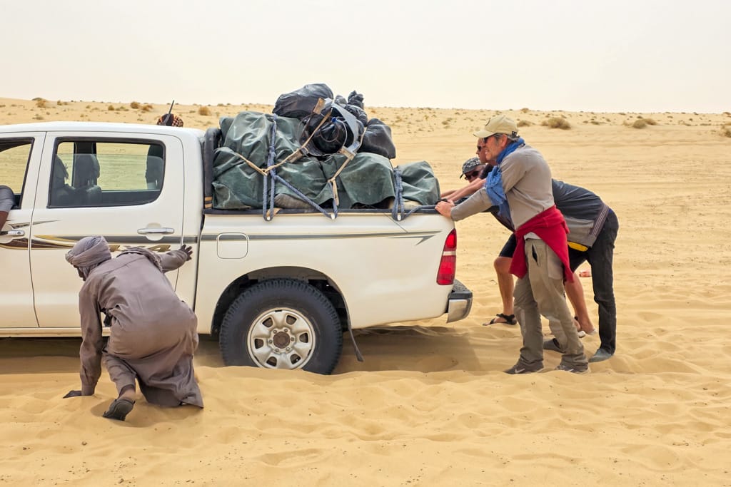
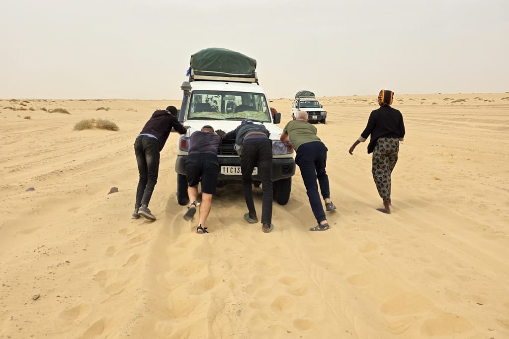

On the remote desert route connecting Mao and Zouar—about 1,000 kilometers—there is practically nothing. There are only a couple of towns of any size—crossroads where travelers can buy some supplies, refill their water, and, in the case of Soultou, the main town along the route, refuel their vehicles with Libyan gasoline.

On this long journey from the Sahel, the days on the road are long, and each day feels much like the last. We get up at 5:00 a.m., take down the tents, have breakfast, load the vehicles, and hit the road.
Along the way, we stop to get water from a well or in a small town. Around 12:00 noon, we stop for lunch. In the afternoon, we keep driving until it gets dark and look for a good place to camp.
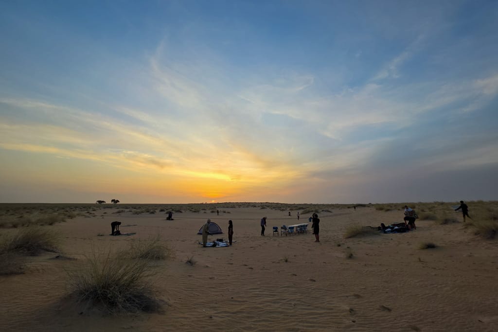
On the endless desert plains, we enjoyed some magical sunsets and met some friendly shepherds and Daza people.

Soultou, border town
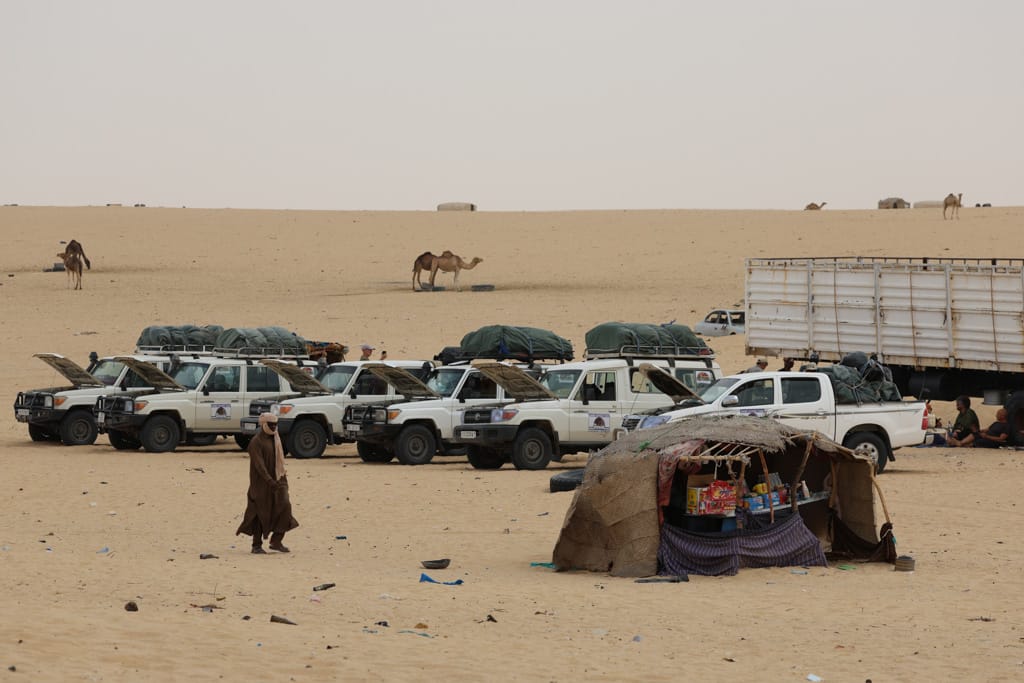
Arriving in Soltou was like arriving on another planet. Even so, the stop of a couple of hours in this town located no more than 10 km from Niger was tremendously interesting.
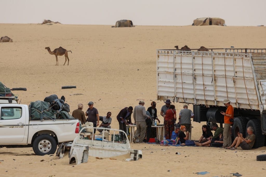

The atmosphere created by the abandoned vehicles coming from Libya and the houses scattered here and there, some shepherds with their camels, remnants of war and some travelers who had stopped to rest and pray, offered spectacular images.

As usual in all our trips in Chad, every two or three days we had to replenish fuel, fresh food if any, water and buy some Asian luxury such as a moderately fresh coke. In addition, being a town with a certain strategic importance, we had to present ourselves to the local authorities and present the travel permits.
We continued our journey across endless sandy plains dotted with dunes to the Enneri (dry river) Erkoub, seeking shelter from the wind among some trees. The cover and camouflage provided by the numerous trees and dunes along the Enneri Erkoub had served as military outposts during Chad’s various wars.
“Enneris” is the name given to the dry riverbeds in the Tibesti. In Arabic and in the rest of Chad, these dry riverbeds are called “wadis” or “ouadis.” Along them, we always find wells where we can get clean water, many of which are simply holes in the ground. After several days of long travel, we reached Ehi Atroun, which indicated that we weren’t far from the Tibesti Mountains.

Erg Bilma
After several days of monotonous landscapes, broken only by a few wadis, a few towns, and the Ehi Atroun, we arrived at a spectacular chain of dunes: the legendary sea of sand from the Erg Bilma in Niger. The wide track that connects Faya with Zouarke and Libya—in this section—winds through beautiful, slender golden dunes.
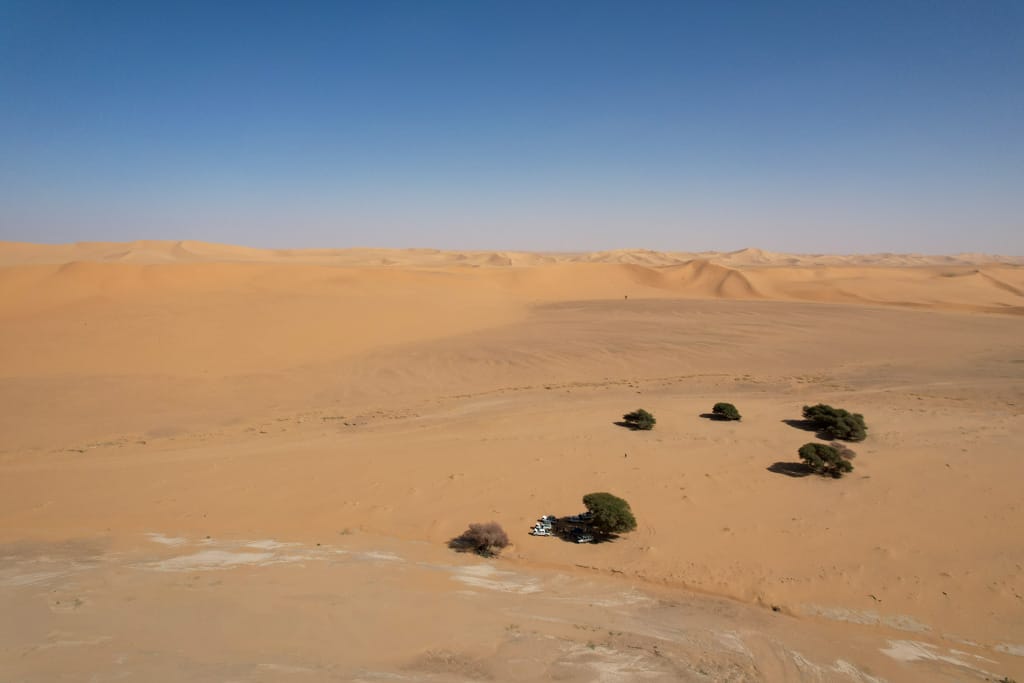
The Zouar Canyon (Enneri Zouar)
The Enneri Zouar is, in my opinion, the most picturesque, beautiful, and perhaps also the most important river valley of all those we know of in the Tibesti Massif.
After five long days of traveling along the lonely roads of the Sahel and across endless desert plains, arriving at the Zouar Canyon—with its lush vegetation and incredible rock formations—was absolutely wonderful. We were entering the Tibesti Mountains.
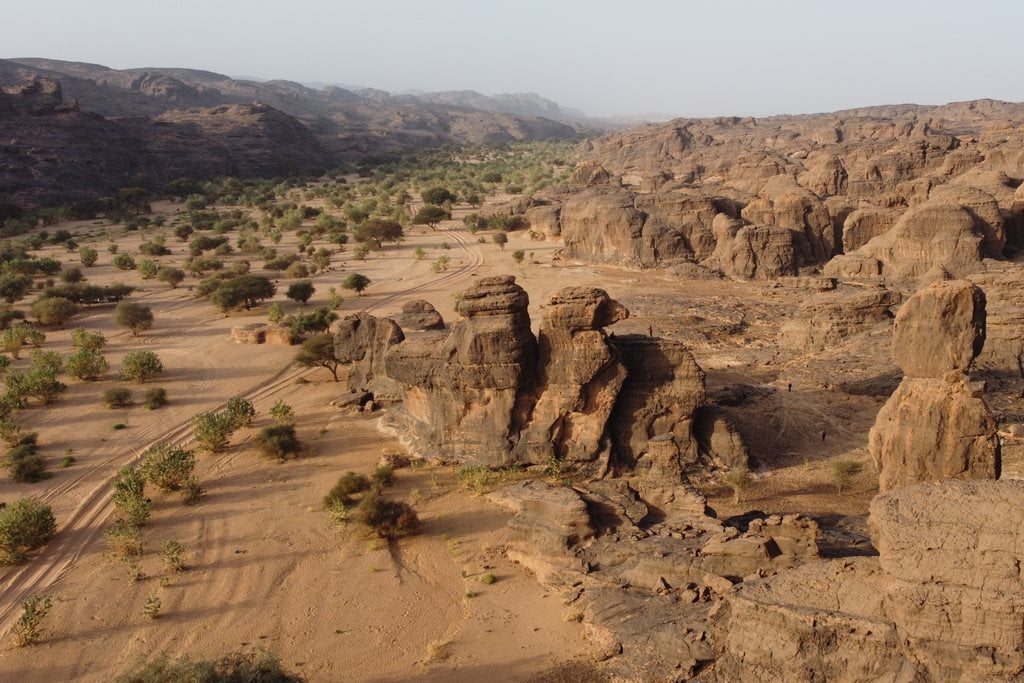

The villages of Zouar and Zouarque are connected by a beautiful canyon from which countless Enneris emerge into the Tibesti massif. It would take weeks just to explore this part of the Tibesti. We entered two different canyons, discovering incredible landscapes, small villages and artisanal gold mines. After presenting ourselves to the authorities, we toured these two villages on foot, visiting stores, restaurants and chatting with the locals.


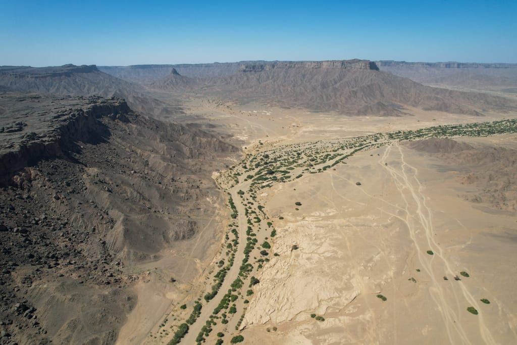

Zouar and Zouarke
The centers of Zouar and Zouarque are two lively localities that serve as logistic centers between Libya and the center of Chad. In their streets we find traders and prospectors coming from different parts of Africa. There are many stores dedicated to the sale and purchase of gold.


After restocking on water, diesel, and fresh food in Zouar and Zouarke, we set off into the depths of the volcanic labyrinth of the Tibesti Massif. The feeling of arriving in the town of Zouar—with its large market full of goods, its restaurants, its bars, and even its internet café—was like that of someone arriving in a city for the first time after living in the countryside. Some passengers also stocked up on blankets for the cold Tibesti nights, and yes, we also drank and bought plenty more beers at the local bars in Zouarque.

In both Zouar and Zouarke, a large portion of the businesses are dedicated to buying and selling gold and meeting all the miners’ logistical needs. Furthermore, Zouarke is an impressive transportation hub, undoubtedly one of the main centers of trade in the entire Sahara.
From Zouarke, the route splits into two: the first, which is very difficult, leads to Bardai via the Trou de Natron, and the other, the main route, leads to Libya and Bardai and is also suitable for trucks.

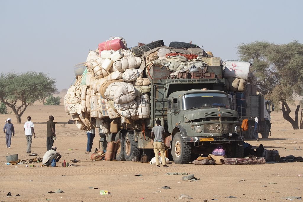
Route from Libya to Chad: truck drivers
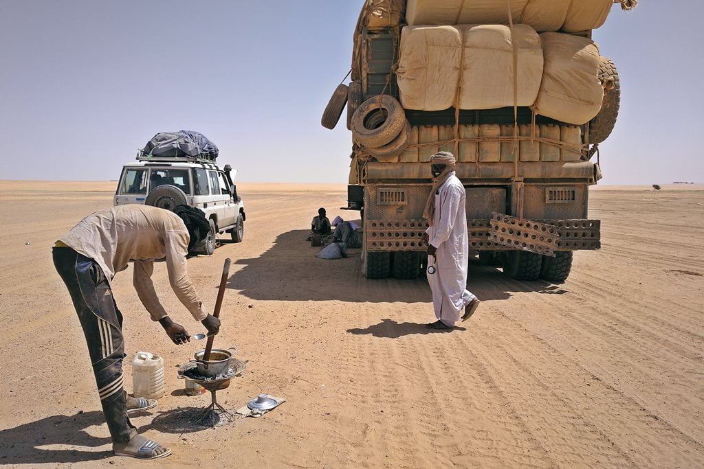
One of the busiest trade routes in the Sahara is the one connecting Sabha in Libya with Mao, Mossouro, and/or N’Djamena in Chad through the Tibesti Mountains. Dozens of trucks deliver Libyan goods (sugar, tea, fuel, packaged foods, machinery, etc.) to northern and central Chad, a landlocked country with few resources (the south is supplied from Douala, Cameroon).
Even today, with all the problems the country is facing, Libya remains the economic powerhouse of the entire region. The remote town of Zouarke is also, surprisingly, very well-stocked with goods and fresh food, and even has electricity and Wi-Fi—something unheard of in this part of the world. Many truck drivers stop in Zouarke to rest up and continue their journey across the sands toward the south of the country.

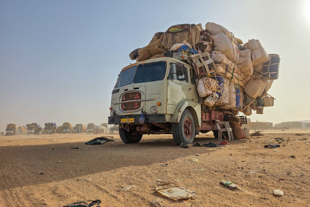
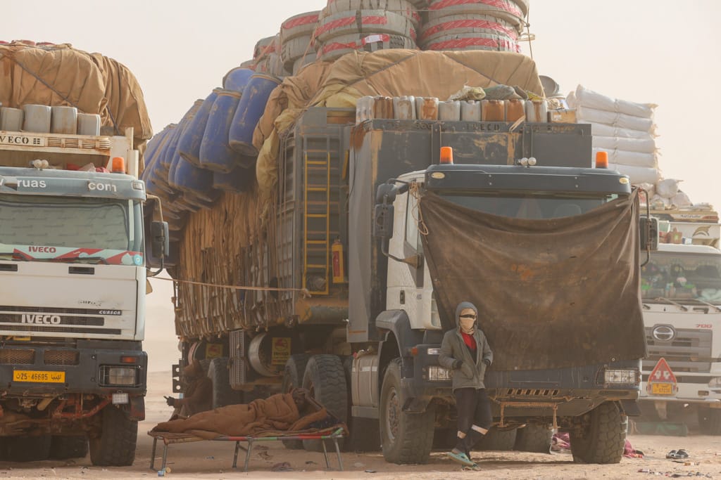


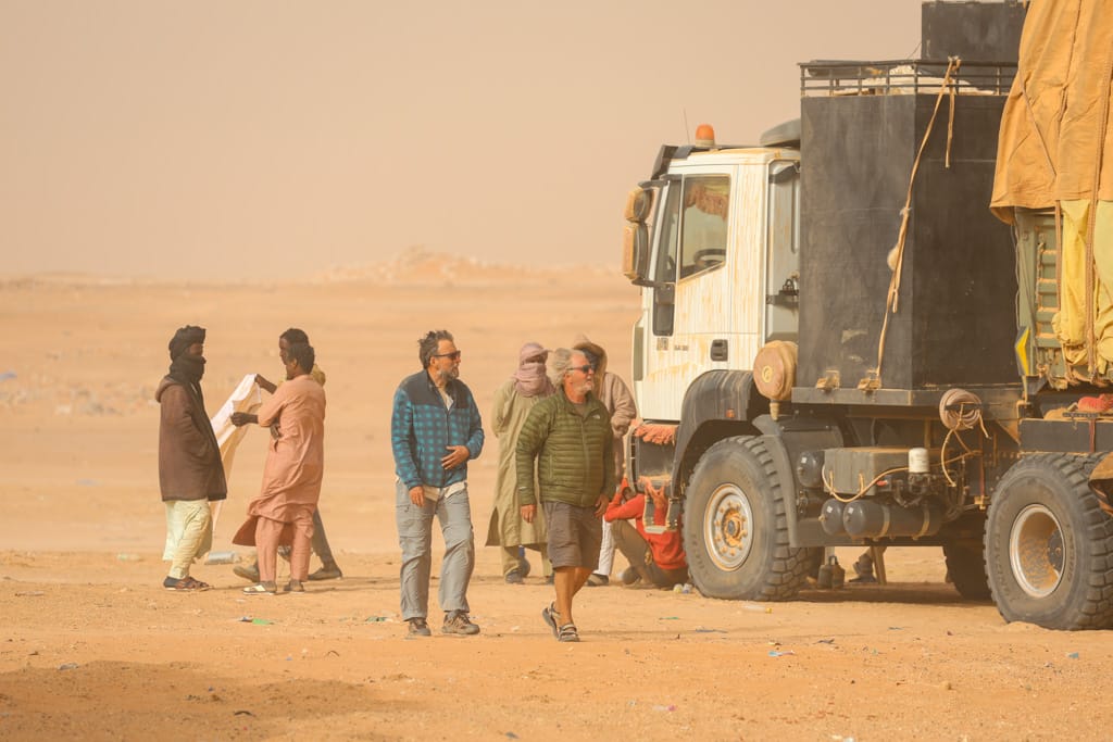
A route that will take about 20 days, if all goes well and no problems arise.
Each truck driver has two assistants who are in charge of cooking, making tea, fixing minor mechanical problems, and adjusting tire pressure—the main task when traveling through the desert. The drivers rest in the shade of the truck, while, under the blazing sun, the assistant cooks a simple stew made of okra and sun-dried tomatoes.
The unwritten laws in this part of the world say that the drivers will normally be of Sudanese origin and the truck owners of Tubu origin.
Track to the Trou de Natron
After the last checkpoint, the route ascends towards the Trou de Natron along a rocky path through dry riverbeds, volcanic ravines and rocky plains.
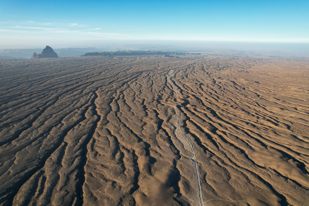
First straight ahead and then to our left, Mount Tousside, at 3,313 meters, is the second-highest peak in the Sahara. At its base lies the Trou de Natron crater. As we climbed, another great peak came into view to our right: Mount Botoum, equally impressive.

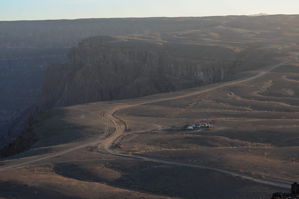
With the trail restored by 2025, it took us four hours to cover the few dozen kilometers separating Zouarke from the rim of the Trou de Natron crater. In fact, we didn’t reach the small shelter—a campsite located near the caldera—until well into the night.
Caldera of the volcano Trou de Natron, the abyss
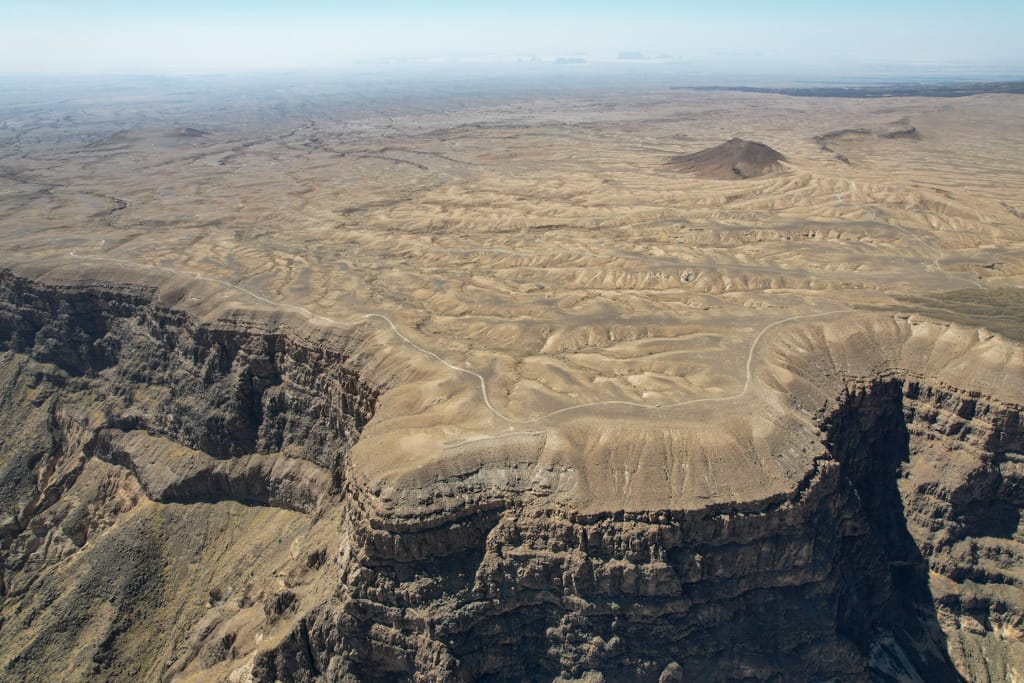
At the foot of Mount Toussidé (3,313 m), the second-highest volcano in the Tibesti Mountains, lies one of the most spectacular sites in the Tibesti and in all of Chad. It is the caldera of the Trou de Natron volcano. If you look at one of our drone photos, you’ll see how an impressive 800-meter-deep chasm rises up from the vast plateau.

The Trou de Natron caldera is 8 kilometers wide and 700 meters deep. The white patch visible at the bottom of the crater is natron (sodium carbonate), dissolved from volcanic materials by water that evaporates from intermittent rainfall.
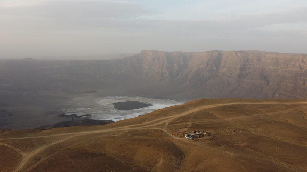
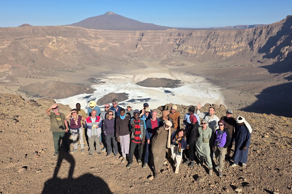
The Teda herders who live in these remote regions of the Tibesti descend with their donkeys into the Trou de Natron, where they harvest natron. They then grind the natron and mix it into the camels’ feed, supposedly to strengthen them.

Inside the Trou de Natron crater, we also find three spectacular dark ash cones rising from the white crater floor. One of them—the most spectacular—is a perfect truncated cone 100 meters high.
In the vicinity of these cones, we find hot springs that indicate there are still active volcanic features deep underground.

No one knows when or how the Trou au Natron was formed—whether it was created by a massive eruption, a collapse, or both. The deposits at the top of the slopes suggest that there was once a lake perhaps 500 meters deep, evidence of the dramatic changes the Sahara has undergone.

Descent into the interior of the Trou de Natron caldera
The descent into and subsequent ascent from the Trou de Natron isn’t for everyone. In 2026, some travelers descended into the crater, while others went on hiking excursions around the outside of the crater. In both cases, the scenery is truly breathtaking.
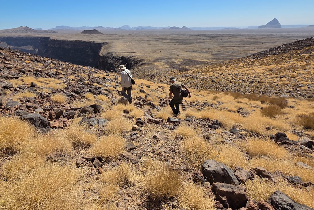
Very early in the morning, after breakfast, the travelers heading inland left our camp, located at an altitude of 2,230 meters, to begin their descent. The descent isn’t particularly difficult since it takes place first thing in the morning, when the heat and the sun aren’t too intense yet.
Once you’re down there, the sand and natron make it hard to move, and the heat starts to become unbearable, so it’s a good idea to pace yourself and take a break.


The route from the Trou de Natron to Bardai
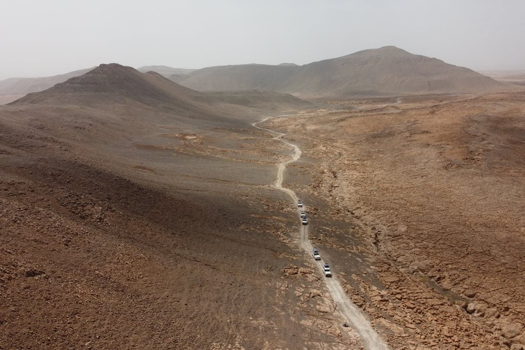
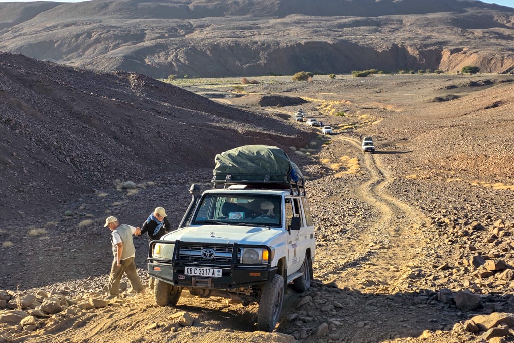
Once again, we continued our journey in our vehicles through an unusual, truly spectacular landscape. As would become a constant feature of the Tibesti, the trail—if you could even call it that—was a veritable hell that constantly tested the endurance of the vehicles, drivers, and passengers alike. Some travelers decided to stretch their legs and continue on foot. After all, we were moving at the same speed.
The Oudingueur Gorge
The route to Bardai, the heart of the Tibesti, descends into the winding Oudingueur Gorge. The trail barely winds its way into the gorge.
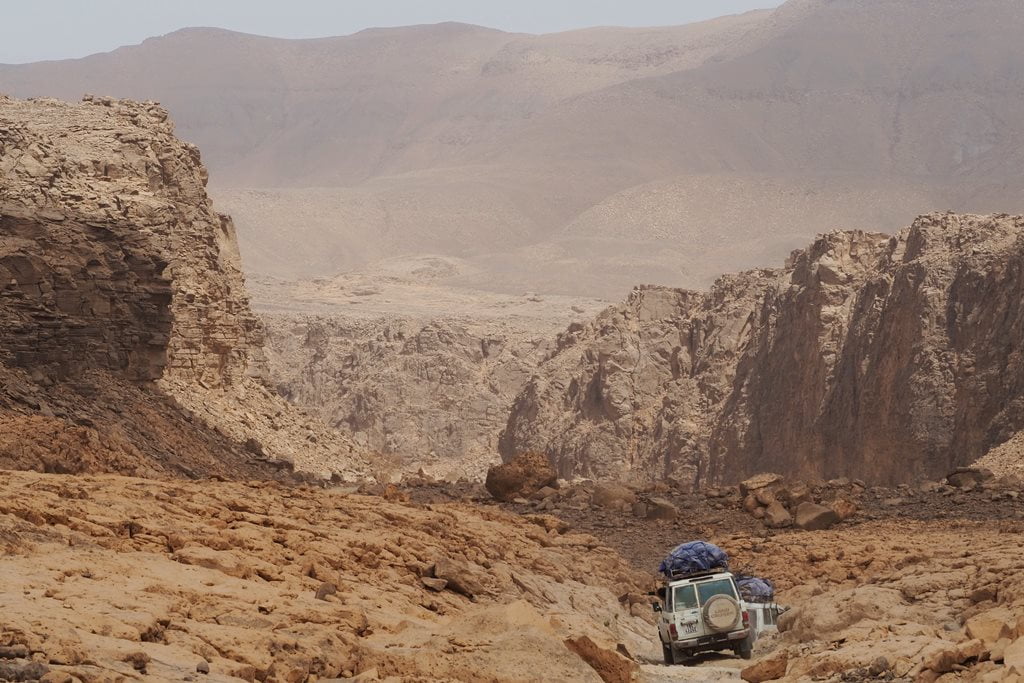
The Enneri Oudingueur is one of the main underground watercourses in this part of the Tibesti. These waters have carved a narrow gorge between the sandstone walls and the fields of volcanic rock. In the Oudingueur Gorge—as well as in the Zouar Canyon, the Gonoa Valley, and the Bardai Valley, to name a few—there are numerous rock art sites, making it a true paradise for any art lover. We decided to stop at the Gonoa site, the most important in all of Tibesti.
Site of Gonoa, rock art in Tibesti
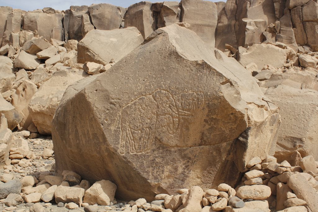
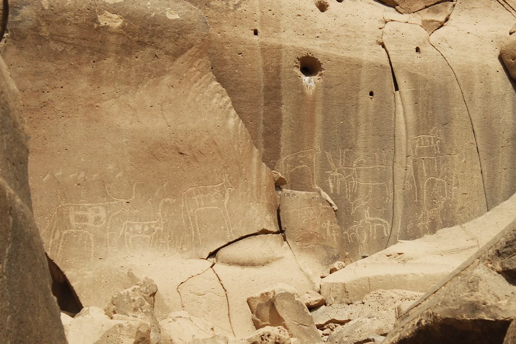
More than 700 engravings from different periods make up the Gonoa archaeological site. Of all these engravings, the famous “Man of Gonoa” is the one that has sparked the most curiosity. This engraving depicts a “masked hunter” nearly two meters tall. The hypothesis is that the “hunter period” in Gonoa began around 5000 B.C.

The subjects depicted on the rock walls of Gonoa include wild animals such as elephants, giraffes, and rhinos, as well as domestic animals. There are also human figures.
In Tibesti, there are countless sites with rock engravings. Any stop along the route where there are rocks reveals a large number of examples of rock art.
Bardai, capital of Tibesti
Inhabited since ancient times and later used as a military base, the thriving town of Bardai is situated in a spectacular setting at an altitude of 1,000 meters, surrounded by vast palm groves and dramatic rock formations.
This imposing river valley is the only one with a more or less significant date palm cultivation and a substantial permanent population, along with Zouar, Yebbi Souma, and Yebbi Bou. In fact, in Bardai, one can find the occasional housing development and even a few multi-story buildings—presumably for high-ranking officials and major merchants.
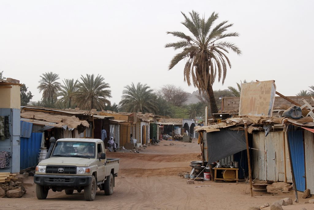
Bardai’s well-stocked stores and stalls are full of products coming from nearby Libya, much more accessible than the Chadian capital. Bardai is a very pleasant place to stroll and make contact with the population of Tibesti. Also even to take some beer, that although it seems incredible, here they arrive. That yes to about 5 euros the bottle.


Contrary to what one might imagine, the people of Bardai are extremely friendly and always greet us and invite us to take pictures, which is unusual in northern Chad.
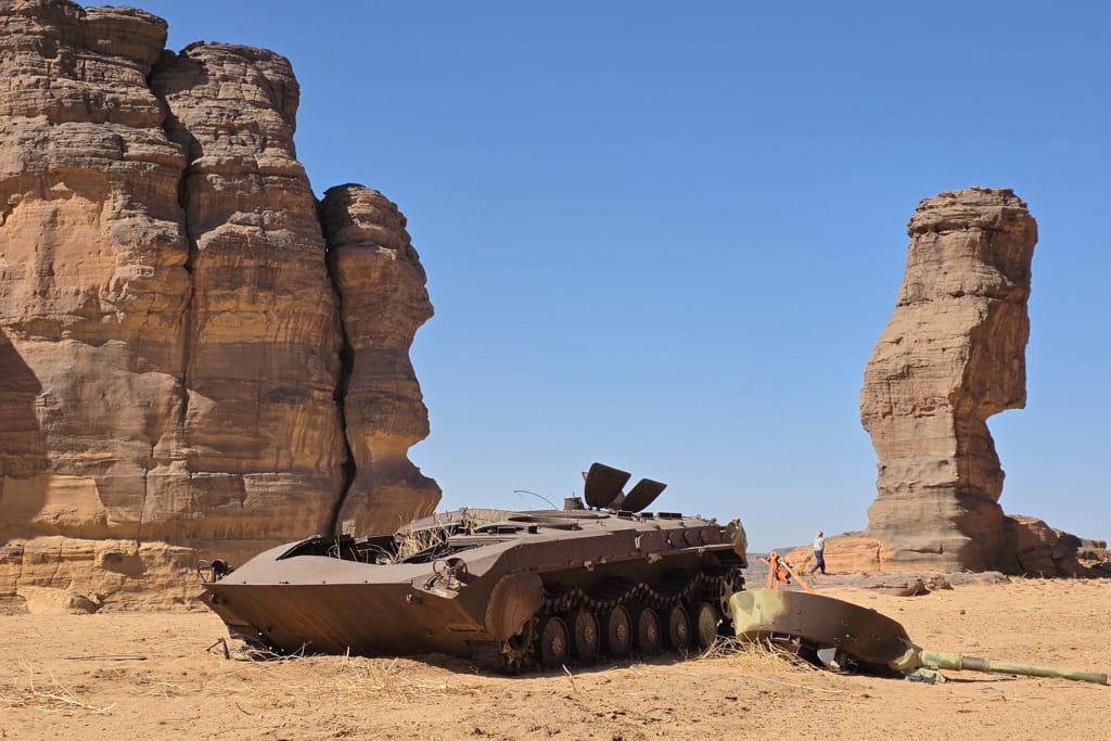
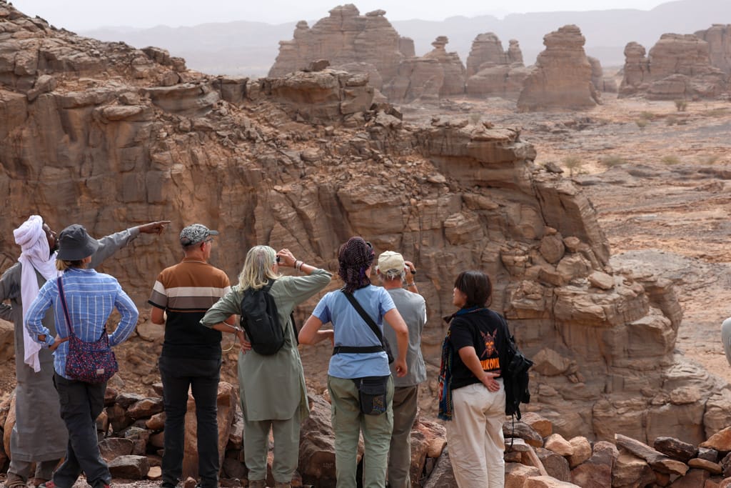
The area around Bardai invites you to lose yourself there for several days. Wherever you look, you’ll find beautiful rock formations, canyons, and palm groves. Because this has historically been a complex and strategically important area during past wars, there are many abandoned military outposts, which we visited. Also, as is the case in other parts of the Sahara, it is possible to find numerous pre-Islamic burial sites.


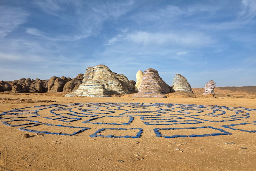
Coloring the desert in Bardai
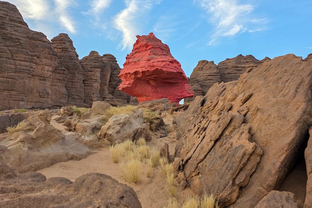
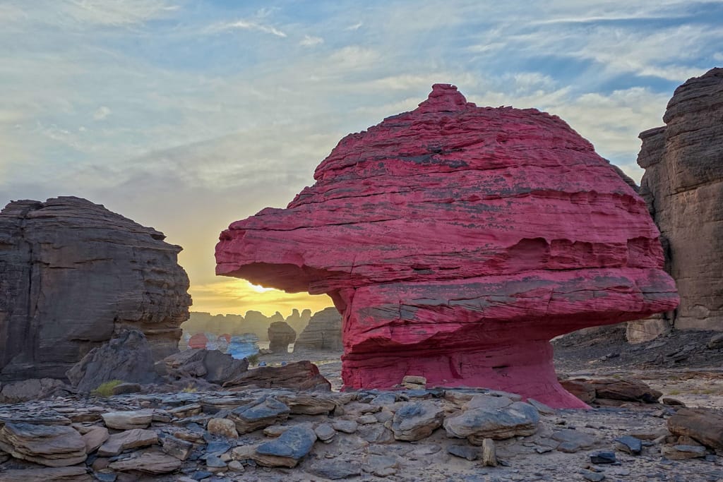
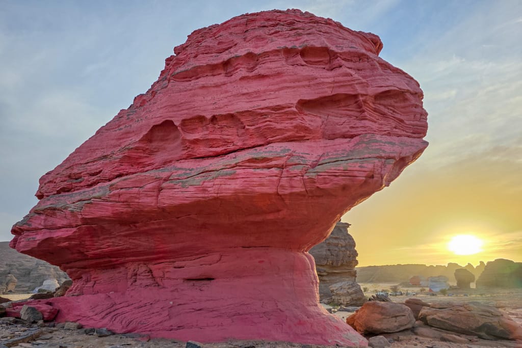
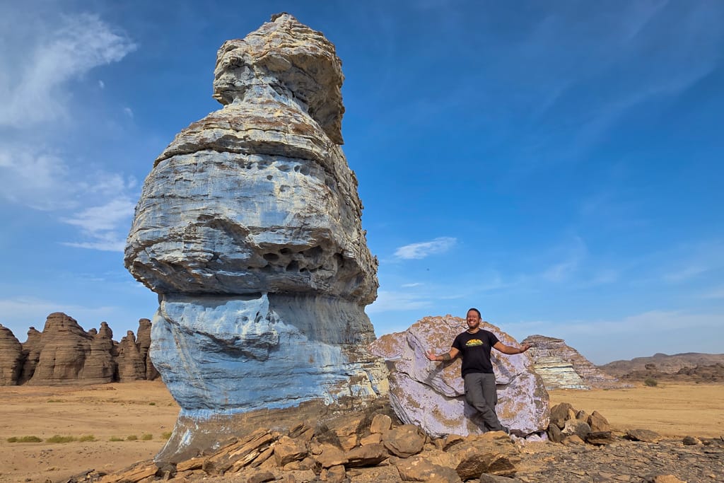
In the surroundings of Bardai we find the peculiar artistic work of Land Art by Jean Verame realized in 1989. The rocks colored by Jean Verame offer different landscapes, surreal and in our opinion beautiful.
We spent two days exploring this incredible corner of the Tibesti on foot, with its colorful rock paintings and dramatic landscapes.

Images on the work of Jean Verame in Bardai, Tibesti




Enneri Zoumri
After leaving Bardai we enter the valley of Enneri Zumri. Beautiful landscapes dotted with traditional Teda villages and oases of radiant green. The track runs this time through imposing sandstone gorges where we stop to walk and take pictures.

From Enneri Zoumri to Yebbi Souma
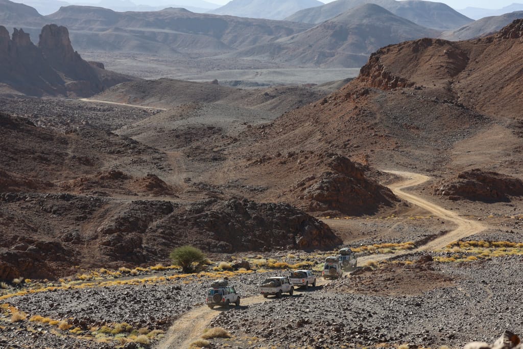
After passing through the Zoumri Gorge, we arrived at the town of Yebbi Souma. Once again, the landscape became rugged, desolate, and harsh. We also came across some exceptional examples of rocks featuring a multitude of basalt columns.

Tedas, inhabitants of Tibesti
The inhabitants of the Tibesti are known as the Tedas (the “people of the rock“). Their societies are based on patrilineal clans, which share the oases, pastures, and wells.
The Teda are an ethnic group that lives primarily in northern Chad, but also in southern Libya. Although they have traditionally been herders and nomads, many in the Tibesti region are now involved in the gold trade.

The harsh life of herders and nomads, along with the scarcity of pasture and water, has led many residents of Tibesti to trade their herds of dromedaries for 4×4 trucks, satellite internet, and all the equipment needed to extract gold from artisanal mines.
As a direct result of the extremely harsh geographical conditions in which they live, the Teda are individualistic, tireless people with a fierce and indomitable spirit.

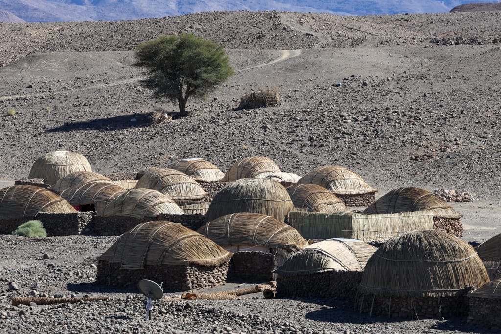
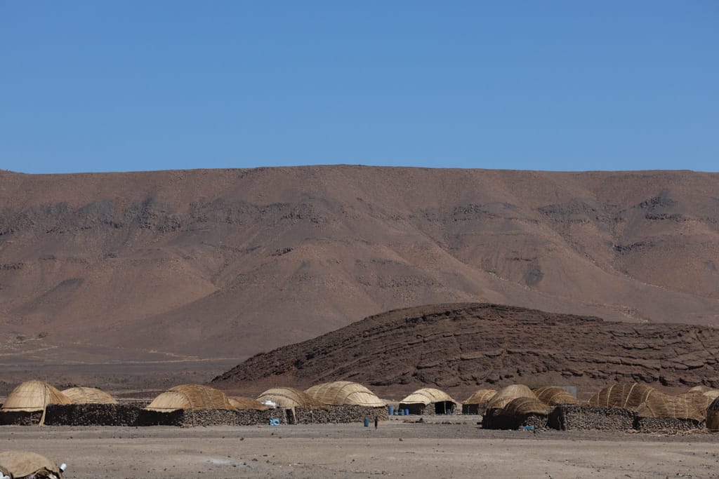
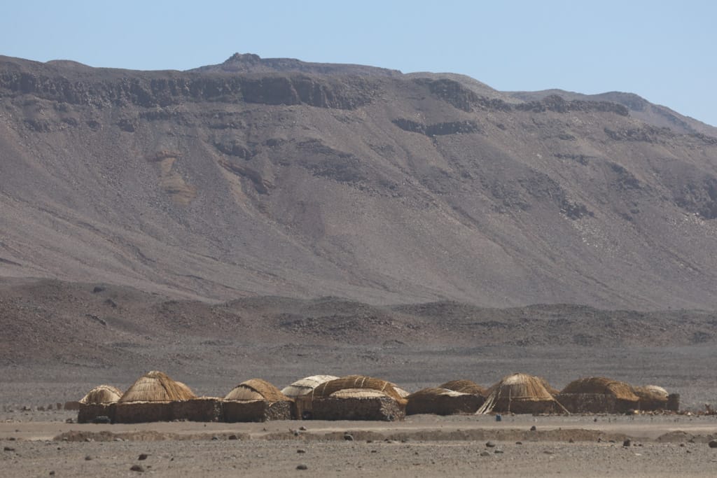
Typical Teda constructions of Tibesti
The traditional Teda buildings of the Tibesti region are characterized by their functional design, adapted to the arid and mountainous environment; they consist mainly of circular stone houses with roofs made from palm fronds. They reflect a vernacular architecture adapted to local materials. This time, without any trouble from the rebels, we were able to visit several traditional villages.

Canyons and palm groves
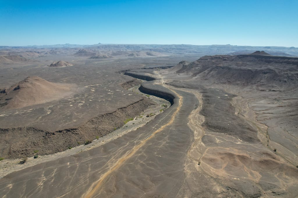
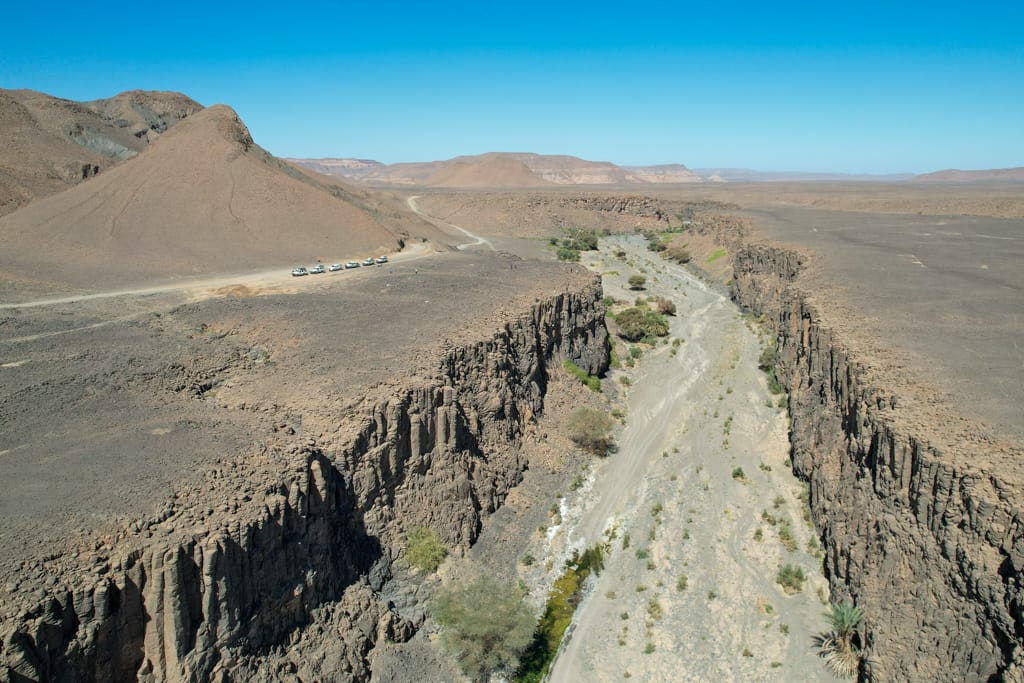
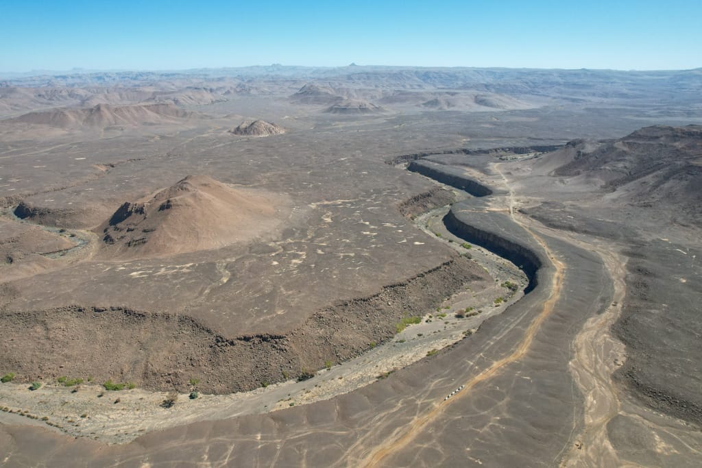
Yebbi Souma and his spectacular cannon
Before reaching Yebbi Souma, the trail leads to the edge of a steep canyon. We stop repeatedly to walk and admire the winding cliff.
Yebbi Bou and its spectacular palm grove
The village of Yebbi Bou, with its many traditional-style houses, is located on a steep cliff. In the depths of the valley is a lush palm grove and a small stream.


The old villages of Yebbi Bou and Yebbi Souma were located deep within the valley, but their inhabitants have now chosen to settle on the upper reaches of the impressive geological fault. After introducing ourselves to the local authorities and discussing the condition of the road, we continued on toward Gouro (east).


Eastern Tibesti and its breathtaking scenery
As soon as we left Yebbi Bou and its small airstrip (used as a local airport), with an old, crashed airplane on it, the road—if you can call it that—became indescribably difficult.
Once again, we had to drive through some rocky mountain passes at an altitude of over 2,000 meters, circling the Tarso Guezendi volcano—paths more suited to goats than to 4x4s. That said, it was undoubtedly worth the effort. The view was spectacular.


The new route offered us the most breathtaking volcanic landscapes we had seen so far, while also posing a constant challenge to the drivers, who had to demonstrate their best driving skills with every meter they traveled.
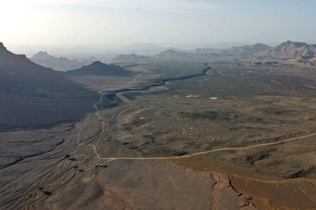
The breathtaking panoramic views unfolded one after another around every bend until late afternoon. We descended along the rocky trail to a large plateau known as Brague. With the last rays of daylight, we decided to spend the night next to a small ravine at an elevation of 1,800 meters—the only possible shelter from the wind we could find in the area.

Tassili Kezen, the Tibesti dream landscapes
The Brague plateau is the transition between the volcanic landscapes of the steepest mountains of Tibesti with the most beautiful fantasy scenes formed by cliffs, sand and sandstone rock.

The track became somewhat more passable and began to descend through a plain of black volcanic rock until it reached a cliff that showed us what was coming before us: the Tassili Kezen, the most moving landscapes of the Chadian Sahara. A sea of sand and dunes dotted with the most striking rock formations. To our right, the dust of the harmattan that early in the day gave us a break, we could see the silhouette of the Emi Koussi, roof of the Sahara with its 3,415 meters.

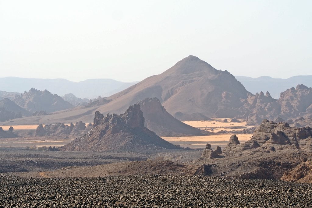
A large sandstone ridge cut through two spectacular dunes, while connecting two enormous mounds of dark rock. This ridge offered the most spectacular vantage point imaginable from which to gaze upon the vast Tassili Kezen.
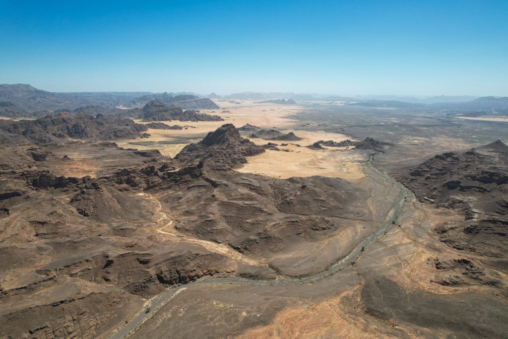
Throughout the day we walked through the fascinating Tassili Kezen, stopping at every turn to take pictures and randomly entering impressive canyons that looked like the eastern foothills of the Emi Koussi. The color of the sand went from golden to white ending in red dunes at the end of the Tassili.

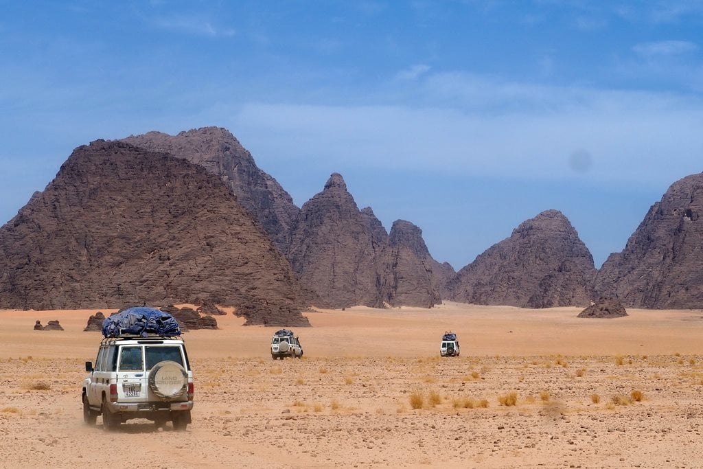

Ouadi Drosso and the exit of Tibesti
We continued our journey, slowly descending from the Tassili Kezen plateau toward Gouro, first through the Ouadi Magan and then through the Ouadi Dross. Once again, a few villages began to appear along our route, and with them came the opportunity to replenish our meager water supply at a well.


Gouro, the most beautiful town in Chad
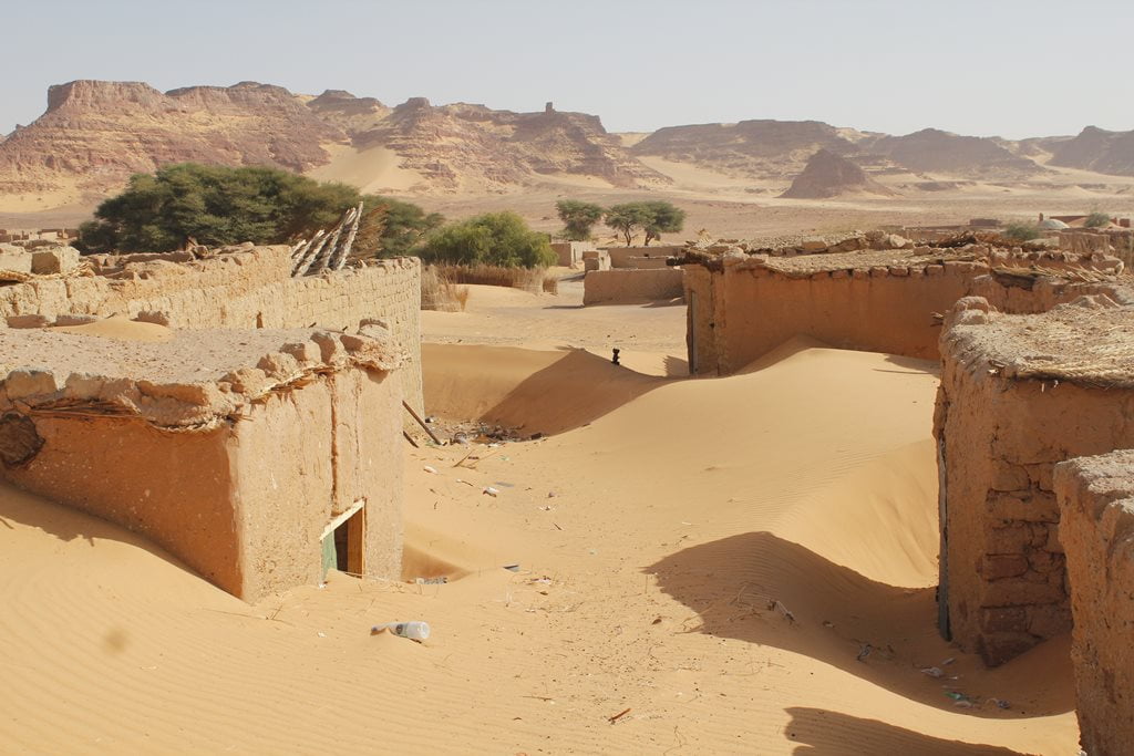
Our arrival in Gouro was once again spectacular. From the military checkpoint, we could see the beautiful town nestled beneath impressive dunes and cliffs, in the middle of a vast palm grove. After spending the night there, we would have the opportunity to explore the town in depth.

The town of Gouro, strategically located along the routes from Ounianga to Kufra (Libya) and on to Tibesti and Faya, has been suffering from depopulation in recent times. Unstoppable desertification and the search for a better future in Libya or Ndjamena have left many of their homes buried in the sand.

With just enough fuel to reach Ounianga Kebir, we set off again.

Ounianga “Big” Ounianga
The town of Ounianga Kebir, with its stunning lake surrounded by dunes and palm trees, marked our return to an area that was well known to me and the local team. All that remained was to head back to Ndjamena—a long journey of several days lay ahead, but one that was just as interesting. Before setting out on the return trip, we enjoyed a wonderful swim in a beautiful natural spa.

Travel to Tibesti
If you’d like to travel to Tibesti or anywhere else in Chad, please contact us by email at info@kumakonda.com.

Autor:
Austerio Alonso
Co-founder of Kumakonda. Passionate of Africa. Specialist in the design, preparation and realization of expeditions in Africa. Content creator.
Travel with us